Burlington night lights from space
Night Light of Burlington (Iowa) from space (United States) Src. Average luminocity for 10x10km area is 41.2942% and for 50x50km: 4.6577%.
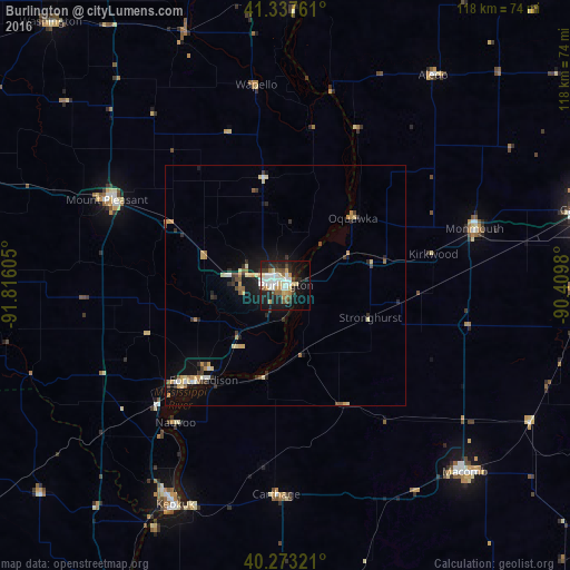
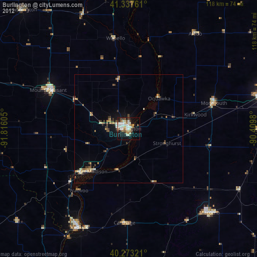
Analysis of Burlington night lights 2016
Square area 10x10 km:
 8.67%
8.67%90-99
8.84%80-89
6.63%70-79
3.74%60-69
3.4%50-59
4.08%40-49
4.59%30-39
4.25%20-29
12.59%10-19
27.04%0-9
16.16%Square area 50x50 km:
0.47%90-99
0.61%80-89
0.84%70-79
0.66%60-69
0.47%50-59
0.41%40-49
0.43%30-39
0.74%20-29
1.19%10-19
3.75%0-9
90.42%Clear (daylight) street map image can be seen on geolist.org.
Map coordinates:
41° 20' 15.4" North, 91° 48' 57.8" West
40° 48' 27.1" North, 91° 6' 46.5" West
40° 16' 23.6" North, 90° 24' 35.3" West
Some cities around Burlington sort by population:
• Galesburg
64.3 km =40 mi,  75°
75°
• Muscatine
68.8 km =42.8 mi,  4°
4°
• Macomb
53.7 km =33.4 mi,  136°
136°
• Fort Madison
26.1 km =16.2 mi,  220°
220°
• Keokuk
51.1 km =31.8 mi,  206°
206°
• Monmouth
40.8 km =25.4 mi,  73°
73°
• Mount Pleasant
41.2 km =25.6 mi,  294°
294°
• Washington
73.2 km =45.5 mi,  318°
318°
4849826 (p: 25,410)
Sources (retrieved 2019-11-25):
» Earth at Night: Flat Maps 2012, 2016