Mount Pleasant night lights from space
Night Light of Mount Pleasant (Iowa) from space (United States) Src. Average luminocity for 10x10km area is 22.1276% and for 50x50km: 1.5265%.
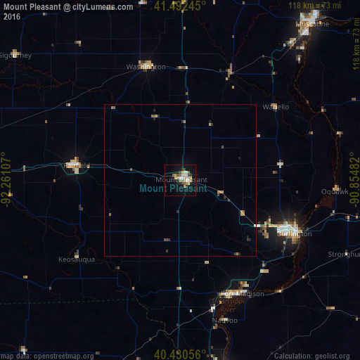
Analysis of Mount Pleasant night lights 2016
Square area 10x10 km:
 2.21%
2.21%90-99
4.08%80-89
3.91%70-79
3.91%60-69
2.04%50-59
2.72%40-49
1.7%30-39
2.72%20-29
2.04%10-19
16.67%0-9
57.99%Square area 50x50 km:
0.08%90-99
0.18%80-89
0.26%70-79
0.26%60-69
0.23%50-59
0.17%40-49
0.21%30-39
0.23%20-29
0.33%10-19
0.71%0-9
97.34%Clear (daylight) street map image can be seen on geolist.org.
Map coordinates:
41° 29' 32.8" North, 92° 15' 39.9" West
40° 57' 49.1" North, 91° 33' 28.6" West
40° 25' 50" North, 90° 51' 17.4" West
Some cities around Mount Pleasant sort by population:
• Burlington
41.2 km =25.6 mi,  114°
114°
• Ottumwa
71.9 km =44.7 mi,  275°
275°
• Muscatine
66.9 km =41.6 mi,  40°
40°
• Fort Madison
42.4 km =26.3 mi,  151°
151°
• Keokuk
64.6 km =40.1 mi,  166°
166°
• Fairfield
34.3 km =21.3 mi, 278°
• Monmouth
76.7 km =47.7 mi,  94°
94°
• Washington
39 km =24.2 mi,  343°
343°
4868205 (p: 8,433)
Sources (retrieved 2019-11-25):
» Earth at Night: Flat Maps 2012, 2016