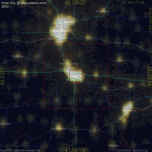
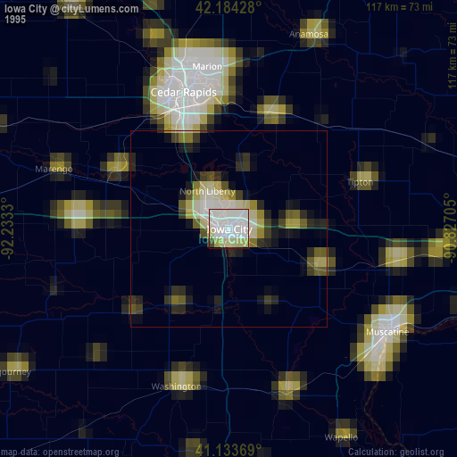
Iowa City night lights from space
Night Light of Iowa City (Iowa) from space (United States) Src. Average luminocity for 10x10km area is 64.6071% and for 50x50km: 7.2386%.
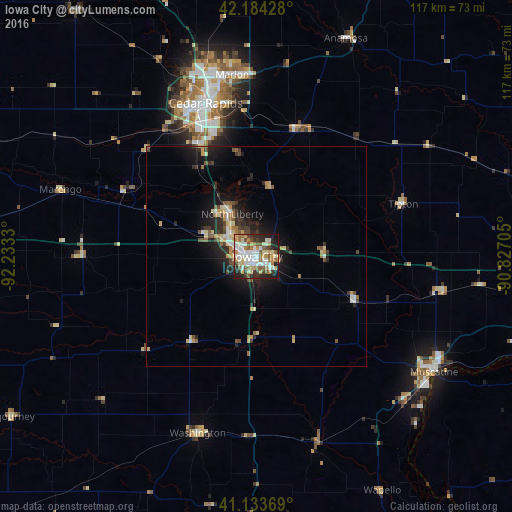
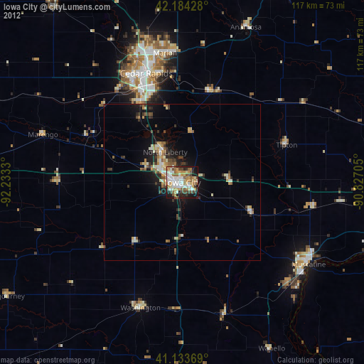
Analysis of Iowa City night lights 2016
Square area 10x10 km:
 15.91%
90-99
14.61%80-89
9.42%70-79
8.44%60-69
9.42%50-59
9.9%40-49
5.84%30-39
4.71%20-29
14.45%10-19
7.31%0-9
0%Square area 50x50 km:
0.87%90-99
0.98%80-89
1.17%70-79
0.9%60-69
0.89%50-59
0.99%40-49
1.02%30-39
1%20-29
2.16%10-19
4.87%0-9
85.14%Clear (daylight) street map image can be seen on geolist.org.
Map coordinates:
42° 11' 3.4" North, 92° 13' 59.9" West
41° 39' 40.1" North, 91° 31' 48.6" West
41° 8' 1.3" North, 90° 49' 37.4" West
Some cities around Iowa City sort by population:
• Cedar Rapids
39.7 km =24.7 mi,  346°
346°
• Marion
41.9 km =26 mi, 352°
• Muscatine
48.3 km =30 mi,  122°
122°
• Coralville
4.5 km =2.8 mi,  292°
292°
• North Liberty
11.3 km =7 mi,  330°
330°
• Washington
42.5 km =26.4 mi,  198°
198°
• Hiawatha
43.5 km =27 mi,  343°
343°
• Anamosa
53.7 km =33.4 mi,  22°
22°
4862034 (p: 74,220)
Sources (retrieved 2019-11-25):
» NASA, Earths city lights 1995
» NASA city lights 2003
» Earth at Night: Flat Maps 2012, 2016