Grandview night lights from space
Night Light of Grandview (Washington) from space (United States) Src. Average luminocity for 10x10km area is 17.058% and for 50x50km: 2.5964%.
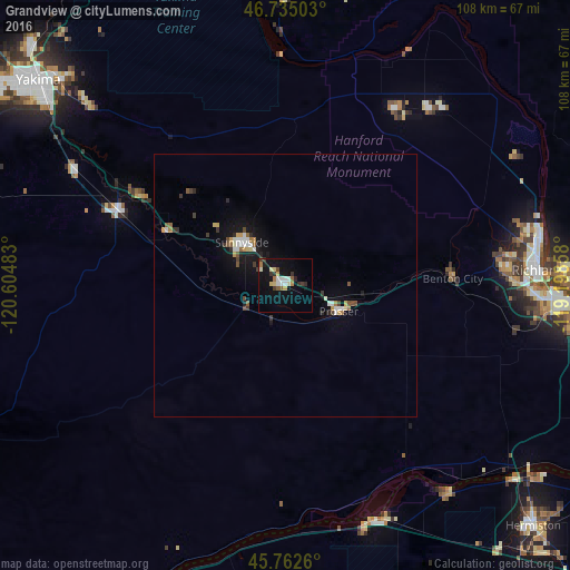
Analysis of Grandview night lights 2016
Square area 10x10 km:
 1.93%
1.93%90-99
3.27%80-89
2.53%70-79
1.49%60-69
1.64%50-59
1.64%40-49
0.89%30-39
3.27%20-29
2.08%10-19
14.73%0-9
66.52%Square area 50x50 km:
0.32%90-99
0.43%80-89
0.23%70-79
0.27%60-69
0.22%50-59
0.32%40-49
0.28%30-39
0.46%20-29
0.32%10-19
2.1%0-9
95.05%Clear (daylight) street map image can be seen on geolist.org.
Map coordinates:
46° 44' 6.1" North, 120° 36' 17.4" West
46° 15' 3.5" North, 119° 54' 6.1" West
45° 45' 45.4" North, 119° 11' 54.9" West
Some cities around Grandview sort by population:
• Richland
47.6 km =29.6 mi,  85°
85°
• Sunnyside
11.5 km =7.1 mi,  314°
314°
• West Richland
41.9 km =26 mi,  81°
81°
• Toppenish
34.3 km =21.3 mi,  294°
294°
• Umatilla
56.9 km =35.4 mi,  130°
130°
• Union Gap
55.6 km =34.5 mi, 307°
• Prosser
11.3 km =7 mi,  115°
115°
• Wapato
45.4 km =28.2 mi,  298°
298°
5795969 (p: 11,176)
Sources (retrieved 2019-11-25):
» Earth at Night: Flat Maps 2012, 2016