Vinings night lights from space
Night Light of Vinings (Georgia) from space (United States) Src. Average luminocity for 10x10km area is 93.1923% and for 50x50km: 88.0724%.
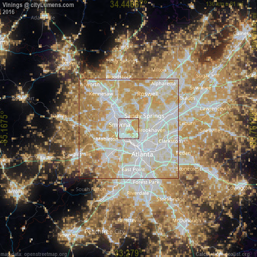
Analysis of Vinings night lights 2016
Square area 10x10 km:
 36.71%
90-99
31.82%80-89
22.03%70-79
9.44%60-69
0%50-59
0%40-49
0%30-39
0%20-29
0%10-19
0%0-9
0%Square area 50x50 km:
29.2%90-99
25.68%80-89
18.38%70-79
16.27%60-69
7.99%50-59
1.32%40-49
0.42%30-39
0.36%20-29
0.28%10-19
0.09%0-9
0%Clear (daylight) street map image can be seen on geolist.org.
Map coordinates:
34° 26' 48" North, 85° 10' 3" West
33° 51' 53.4" North, 84° 27' 51.7" West
33° 16' 44.4" North, 83° 45' 40.5" West
Some cities around Vinings sort by population:
• Atlanta
14.7 km =9.1 mi,  151°
151°
• Sandy Springs
10.3 km =6.4 mi,  50°
50°
• Marietta
12.6 km =7.8 mi,  321°
321°
• Smyrna
5.1 km =3.2 mi,  294°
294°
• Brookhaven
11.5 km =7.1 mi,  93°
93°
• North Atlanta
11.8 km =7.3 mi, 89°
• Mableton
12 km =7.5 mi,  244°
244°
• Fair Oaks
9.4 km =5.8 mi,  307°
307°
4228518 (p: 9,734)
Sources (retrieved 2019-11-25):
» Earth at Night: Flat Maps 2012, 2016