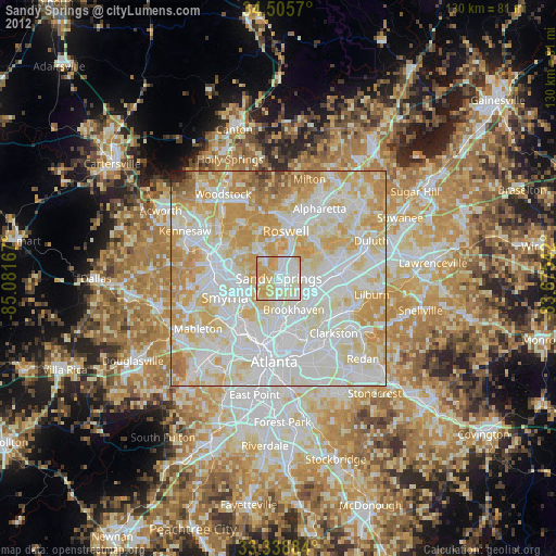
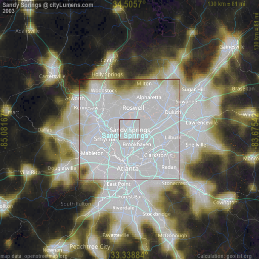
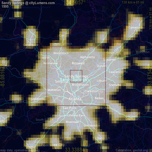
Sandy Springs night lights from space
Night Light of Sandy Springs (Georgia) from space (United States) Src. Average luminocity for 10x10km area is 91.0315% and for 50x50km: 89.128%.
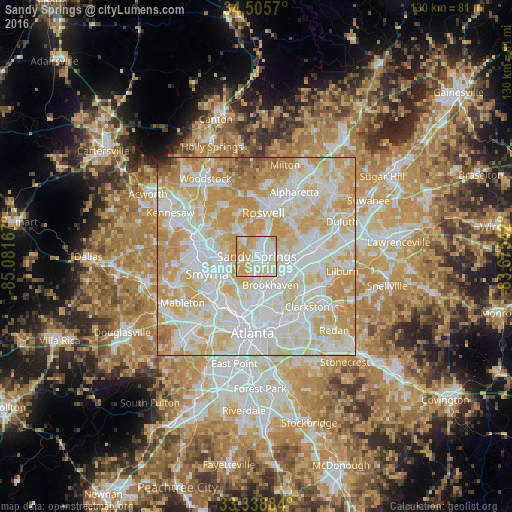
Analysis of Sandy Springs night lights 2016
Square area 10x10 km:
 28.15%
90-99
30.07%80-89
27.97%70-79
13.81%60-69
0%50-59
0%40-49
0%30-39
0%20-29
0%10-19
0%0-9
0%Square area 50x50 km:
29.33%90-99
27.35%80-89
20.05%70-79
16.72%60-69
4.47%50-59
1.18%40-49
0.62%30-39
0.06%20-29
0.22%10-19
0.01%0-9
0%Clear (daylight) street map image can be seen on geolist.org.
Map coordinates:
34° 30' 20.5" North, 85° 4' 54" West
33° 55' 27.4" North, 84° 22' 42.7" West
33° 20' 19.8" North, 83° 40' 31.5" West
Some cities around Sandy Springs sort by population:
• Roswell
11.1 km =6.9 mi,  8°
8°
• Smyrna
13.3 km =8.3 mi,  250°
250°
• Brookhaven
8.1 km =5 mi,  154°
154°
• Dunwoody
4.7 km =2.9 mi,  58°
58°
• North Atlanta
7.6 km =4.7 mi, 149°
• Chamblee
8.2 km =5.1 mi,  115°
115°
• Doraville
9.3 km =5.8 mi,  108°
108°
• Vinings
10.3 km =6.4 mi,  230°
230°
4221333 (p: 105,330)
Sources (retrieved 2019-11-25):
» NASA, Earths city lights 1995
» NASA city lights 2003
» Earth at Night: Flat Maps 2012, 2016