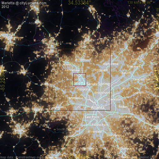
Marietta night lights from space
Night Light of Marietta (Georgia) from space (United States) Src. Average luminocity for 10x10km area is 93.5245% and for 50x50km: 79.4056%.

Analysis of Marietta night lights 2016
Square area 10x10 km:
 41.08%
90-99
32.87%80-89
11.54%70-79
13.64%60-69
0.87%50-59
0%40-49
0%30-39
0%20-29
0%10-19
0%0-9
0%Square area 50x50 km:
20.43%90-99
19.04%80-89
14.89%70-79
17.46%60-69
13.85%50-59
5.78%40-49
3.35%30-39
1.97%20-29
1.94%10-19
1.05%0-9
0.24%Clear (daylight) street map image can be seen on geolist.org.
Map coordinates:
34° 32' 1.8" North, 85° 15' 11" West
33° 57' 9.4" North, 84° 32' 59.7" West
33° 22' 2.5" North, 83° 50' 48.5" West
Some cities around Marietta sort by population:
• Sandy Springs
16.1 km =10 mi,  101°
101°
• Smyrna
8.3 km =5.2 mi,  156°
156°
• Mableton
15.2 km =9.4 mi,  191°
191°
• Kennesaw
9.9 km =6.2 mi,  322°
322°
• Woodstock
16.8 km =10.4 mi,  9°
9°
• Powder Springs
16.1 km =10 mi,  230°
230°
• Vinings
12.6 km =7.8 mi,  141°
141°
• Fair Oaks
4 km =2.5 mi,  173°
173°
4207783 (p: 59,067)
Sources (retrieved 2019-11-25):
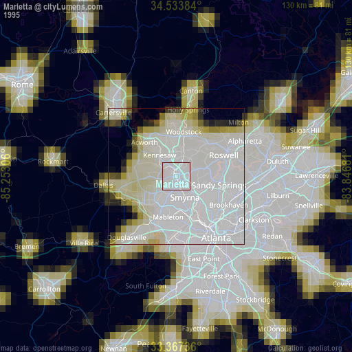
» NASA, Earths city lights 1995
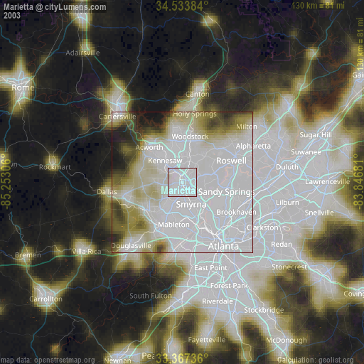
» NASA city lights 2003
» Earth at Night: Flat Maps 2012, 2016