Atlanta night lights from space
Night Light of Atlanta (Georgia) from space (United States) Src. Average luminocity for 10x10km area is 99.3956% and for 50x50km: 88.0639%.
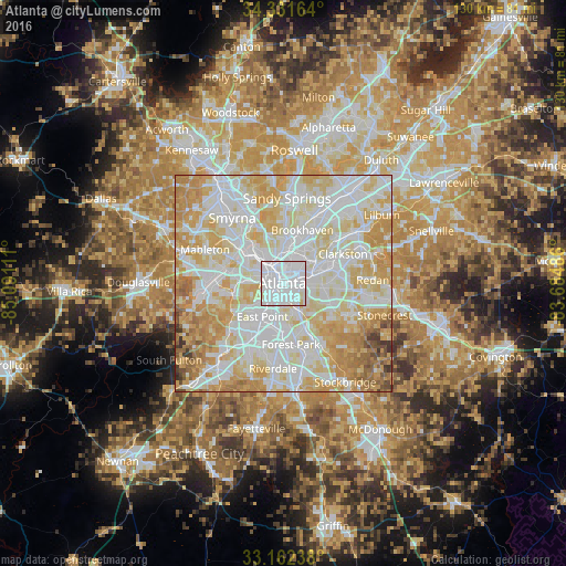
Analysis of Atlanta night lights 2016
Square area 10x10 km:
 79.49%
90-99
19.78%80-89
0.73%70-79
0%60-69
0%50-59
0%40-49
0%30-39
0%20-29
0%10-19
0%0-9
0%Square area 50x50 km:
30.08%90-99
26.31%80-89
18.02%70-79
15.07%60-69
6.35%50-59
1.98%40-49
1.06%30-39
1%20-29
0.14%10-19
0%0-9
0%Clear (daylight) street map image can be seen on geolist.org.
Map coordinates:
34° 19' 53.9" North, 85° 5' 28" West
33° 44' 56.4" North, 84° 23' 16.7" West
33° 9' 44.6" North, 83° 41' 5.5" West
Some cities around Atlanta sort by population:
• East Point
9.1 km =5.7 mi,  211°
211°
• Candler-McAfee
11 km =6.8 mi,  103°
103°
• Decatur
8.9 km =5.5 mi,  71°
71°
• North Druid Hills
10.2 km =6.3 mi,  42°
42°
• North Decatur
8.9 km =5.5 mi,  58°
58°
• Druid Hills
5.9 km =3.7 mi,  53°
53°
• Gresham Park
8.5 km =5.3 mi,  126°
126°
• Hapeville
10.1 km =6.3 mi,  191°
191°
4180439 (p: 463,878)
Sources (retrieved 2019-11-25):
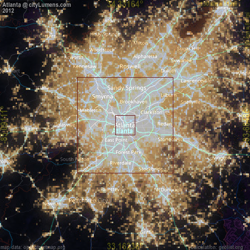
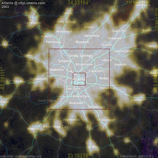
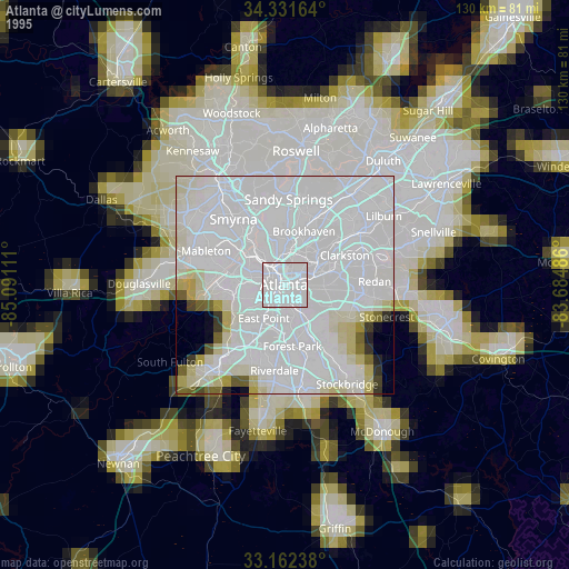
» NASA, Earths city lights 1995
» NASA city lights 2003
» Earth at Night: Flat Maps 2012, 2016