Fair Oaks night lights from space
Night Light of Fair Oaks (Georgia) from space (United States) Src. Average luminocity for 10x10km area is 95.993% and for 50x50km: 82.2728%.
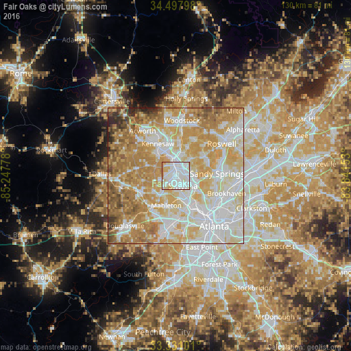
Analysis of Fair Oaks night lights 2016
Square area 10x10 km:
 47.03%
90-99
36.36%80-89
11.01%70-79
5.59%60-69
0%50-59
0%40-49
0%30-39
0%20-29
0%10-19
0%0-9
0%Square area 50x50 km:
22.5%90-99
21.03%80-89
15.68%70-79
17.35%60-69
13.1%50-59
4.96%40-49
2.74%30-39
1.4%20-29
1.24%10-19
0.01%0-9
0%Clear (daylight) street map image can be seen on geolist.org.
Map coordinates:
34° 29' 52.7" North, 85° 14' 52" West
33° 54' 59.4" North, 84° 32' 40.7" West
33° 19' 51.6" North, 83° 50' 29.5" West
Some cities around Fair Oaks sort by population:
• Sandy Springs
15.4 km =9.6 mi,  86°
86°
• Marietta
4 km =2.5 mi,  353°
353°
• Smyrna
4.6 km =2.9 mi,  142°
142°
• Mableton
11.4 km =7.1 mi,  197°
197°
• Kennesaw
13.6 km =8.5 mi,  331°
331°
• Powder Springs
14.3 km =8.9 mi,  243°
243°
• Vinings
9.4 km =5.8 mi,  127°
127°
• Austell
14.2 km =8.8 mi,  215°
215°
4194111 (p: 8,225)
Sources (retrieved 2019-11-25):
» Earth at Night: Flat Maps 2012, 2016