North Atlanta night lights from space
Night Light of North Atlanta (Georgia) from space (United States) Src. Average luminocity for 10x10km area is 96.8601% and for 50x50km: 90.2114%.
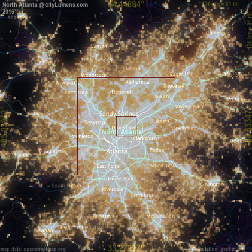
Analysis of North Atlanta night lights 2016
Square area 10x10 km:
 43.36%
90-99
44.58%80-89
12.06%70-79
0%60-69
0%50-59
0%40-49
0%30-39
0%20-29
0%10-19
0%0-9
0%Square area 50x50 km:
31.13%90-99
27.69%80-89
20.63%70-79
16.72%60-69
3.03%50-59
0.36%40-49
0.33%30-39
0.09%20-29
0%10-19
0%0-9
0%Clear (daylight) street map image can be seen on geolist.org.
Map coordinates:
34° 26' 49" North, 85° 2' 23" West
33° 51' 54.4" North, 84° 20' 11.7" West
33° 16' 45.4" North, 83° 38' 0.5" West
Some cities around North Atlanta sort by population:
• Sandy Springs
7.6 km =4.7 mi,  329°
329°
• Brookhaven
0.8 km =0.5 mi,  204°
204°
• Dunwoody
9 km =5.6 mi,  1°
1°
• Chamblee
4.6 km =2.9 mi,  49°
49°
• Decatur
10.7 km =6.6 mi,  159°
159°
• Druid Hills
9.4 km =5.8 mi,  179°
179°
• Doraville
6.1 km =3.8 mi, 53°
• Scottdale
10.7 km =6.6 mi,  141°
141°
4212937 (p: 40,456)
Sources (retrieved 2019-11-25):
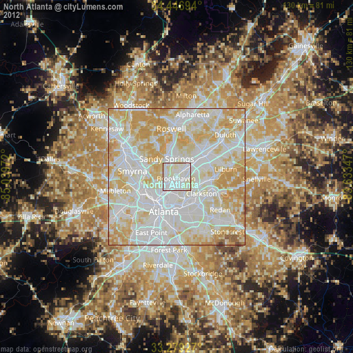
» Earth at Night: Flat Maps 2012, 2016