Vincennes night lights from space
Night Light of Vincennes (Indiana) from space (United States) Src. Average luminocity for 10x10km area is 37.9524% and for 50x50km: 4.4138%.
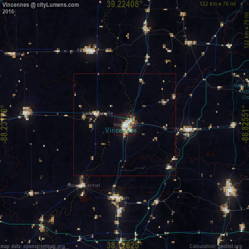
Analysis of Vincennes night lights 2016
Square area 10x10 km:
 6.63%
6.63%90-99
6.63%80-89
6.8%70-79
4.76%60-69
4.93%50-59
4.59%40-49
3.23%30-39
4.42%20-29
8.5%10-19
26.87%0-9
22.62%Square area 50x50 km:
0.41%90-99
0.45%80-89
0.75%70-79
0.56%60-69
0.43%50-59
0.6%40-49
0.64%30-39
0.89%20-29
0.92%10-19
2.57%0-9
91.78%Clear (daylight) street map image can be seen on geolist.org.
Map coordinates:
39° 13' 26.7" North, 88° 13' 54.3" West
38° 40' 38.2" North, 87° 31' 43.1" West
38° 7' 34.5" North, 86° 49' 31.8" West
Some cities around Vincennes sort by population:
• Jasper
60.9 km =37.8 mi,  121°
121°
• Washington
31 km =19.3 mi,  93°
93°
• Olney
48.7 km =30.3 mi,  277°
277°
• Princeton
36 km =22.4 mi,  185°
185°
• Robinson
40.8 km =25.4 mi,  333°
333°
• Mount Carmel
35.9 km =22.3 mi,  214°
214°
• Huntingburg
65.3 km =40.6 mi,  130°
130°
• Linton
50.7 km =31.5 mi,  38°
38°
4266307 (p: 18,012)
Sources (retrieved 2019-11-25):
» Earth at Night: Flat Maps 2012, 2016