Mount Carmel night lights from space
Night Light of Mount Carmel (Illinois) from space (United States) Src. Average luminocity for 10x10km area is 16.3782% and for 50x50km: 4.5513%.
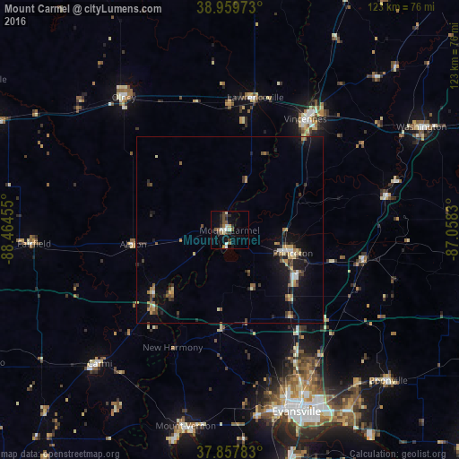
Analysis of Mount Carmel night lights 2016
Square area 10x10 km:
 1.95%
1.95%90-99
2.6%80-89
1.95%70-79
0%60-69
1.95%50-59
3.73%40-49
2.92%30-39
3.41%20-29
3.41%10-19
5.68%0-9
72.4%Square area 50x50 km:
0.31%90-99
0.41%80-89
0.65%70-79
0.45%60-69
0.65%50-59
0.62%40-49
0.68%30-39
1.07%20-29
0.83%10-19
3.33%0-9
91.01%Clear (daylight) street map image can be seen on geolist.org.
Map coordinates:
38° 57' 35" North, 88° 27' 52.4" West
38° 24' 39.2" North, 87° 45' 41.1" West
37° 51' 28.2" North, 87° 3' 29.9" West
Some cities around Mount Carmel sort by population:
• Evansville
51.7 km =32.1 mi,  159°
159°
• Vincennes
35.9 km =22.3 mi,  34°
34°
• Washington
58.2 km =36.2 mi,  61°
61°
• Olney
45.4 km =28.2 mi,  321°
321°
• Princeton
18 km =11.2 mi,  110°
110°
• Boonville
58.6 km =36.4 mi,  133°
133°
• Carmi
49.7 km =30.9 mi,  224°
224°
• Fairfield
52.3 km =32.5 mi,  266°
266°
4244967 (p: 7,027)
Sources (retrieved 2019-11-25):
» Earth at Night: Flat Maps 2012, 2016