Jasper night lights from space
Night Light of Jasper (Indiana) from space (United States) Src. Average luminocity for 10x10km area is 37.3639% and for 50x50km: 3.611%.
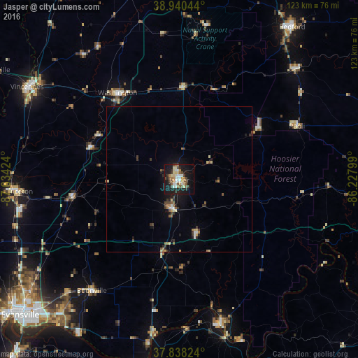
Analysis of Jasper night lights 2016
Square area 10x10 km:
 6.29%
6.29%90-99
6.12%80-89
6.97%70-79
2.72%60-69
3.74%50-59
6.63%40-49
5.27%30-39
3.4%20-29
7.31%10-19
36.9%0-9
14.63%Square area 50x50 km:
0.36%90-99
0.37%80-89
0.58%70-79
0.27%60-69
0.43%50-59
0.6%40-49
0.51%30-39
0.68%20-29
0.66%10-19
2.83%0-9
92.72%Clear (daylight) street map image can be seen on geolist.org.
Map coordinates:
38° 56' 25.6" North, 87° 38' 3.3" West
38° 23' 29.2" North, 86° 55' 52" West
37° 50' 17.7" North, 86° 13' 40.8" West
Some cities around Jasper sort by population:
• Vincennes
60.9 km =37.8 mi,  301°
301°
• Bedford
64.9 km =40.3 mi,  36°
36°
• Washington
36.4 km =22.6 mi,  324°
324°
• Princeton
55.6 km =34.5 mi,  265°
265°
• Tell City
51 km =31.7 mi,  163°
163°
• Knottsville
68.9 km =42.8 mi,  178°
178°
• Boonville
48.4 km =30.1 mi,  218°
218°
• Huntingburg
10.5 km =6.5 mi,  191°
191°
4259640 (p: 15,451)
Sources (retrieved 2019-11-25):
» Earth at Night: Flat Maps 2012, 2016