Lincoln Park night lights from space
Night Light of Lincoln Park (Illinois) from space (United States) Src. Average luminocity for 10x10km area is 83.119% and for 50x50km: 55.094%.
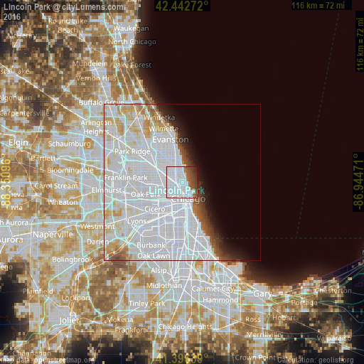
Analysis of Lincoln Park night lights 2016
Square area 10x10 km:
 60.79%
90-99
9.21%80-89
0%70-79
0.32%60-69
3.49%50-59
6.98%40-49
8.89%30-39
6.03%20-29
3.65%10-19
0.63%0-9
0%Square area 50x50 km:
34.39%90-99
11.39%80-89
3.98%70-79
2.58%60-69
1.4%50-59
1.69%40-49
1.62%30-39
1.7%20-29
2.16%10-19
3.11%0-9
35.97%Clear (daylight) street map image can be seen on geolist.org.
Map coordinates:
42° 26' 33.8" North, 88° 21' 3.5" West
41° 55' 18.1" North, 87° 38' 52.2" West
41° 23' 47" North, 86° 56' 41" West
Some cities around Lincoln Park sort by population:
• West Town
3.8 km =2.4 mi,  215°
215°
• Near North Side
2.6 km =1.6 mi,  155°
155°
• Logan Square
4.3 km =2.7 mi,  272°
272°
• Uptown
4.9 km =3 mi,  355°
355°
• Avondale
5.6 km =3.5 mi,  290°
290°
• North Center
4.4 km =2.7 mi,  324°
324°
• Chicago Loop
4.4 km =2.7 mi, 163°
• East Garfield Park
6.4 km =4 mi,  225°
225°
4899911 (p: 66,959)
Sources (retrieved 2019-11-25):
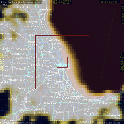
» NASA, Earths city lights 1995
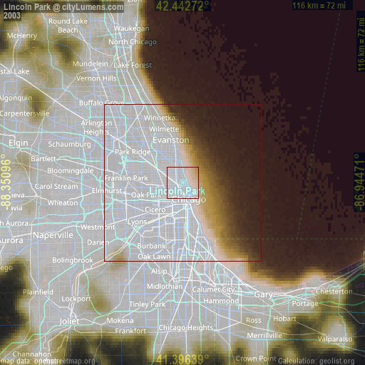
» NASA city lights 2003
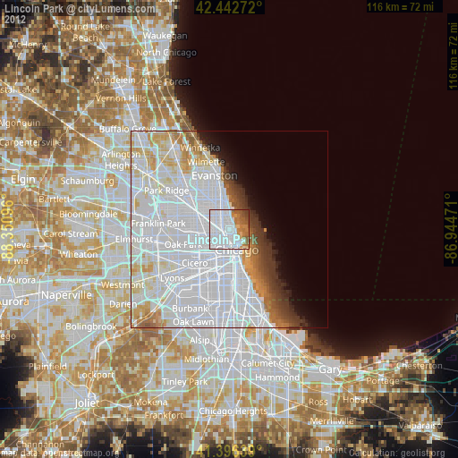
» Earth at Night: Flat Maps 2012, 2016