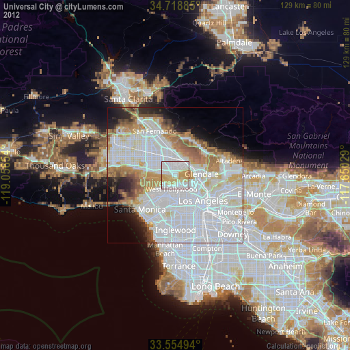
Universal City night lights from space
Night Light of Universal City (California) from space (United States) Src. Average luminocity for 10x10km area is 92.467% and for 50x50km: 67.3953%.

Analysis of Universal City night lights 2016
Square area 10x10 km:
 43.41%
90-99
21.61%80-89
19.23%70-79
15.57%60-69
0.18%50-59
0%40-49
0%30-39
0%20-29
0%10-19
0%0-9
0%Square area 50x50 km:
32.76%90-99
15.41%80-89
5.36%70-79
5.44%60-69
7.02%50-59
4.05%40-49
2.67%30-39
3.16%20-29
4.08%10-19
5.37%0-9
14.67%Clear (daylight) street map image can be seen on geolist.org.
Map coordinates:
34° 43' 7.9" North, 119° 3' 23.5" West
34° 8' 20" North, 118° 21' 12.3" West
33° 33' 17.8" North, 117° 39' 1" West
Some cities around Universal City sort by population:
• Glendale
9.1 km =5.7 mi,  87°
87°
• Hollywood
5.1 km =3.2 mi,  151°
151°
• Burbank
6.2 km =3.9 mi,  41°
41°
• North Hollywood
4.4 km =2.7 mi,  327°
327°
• Sherman Oaks
8.9 km =5.5 mi,  278°
278°
• West Hollywood
5.5 km =3.4 mi,  188°
188°
• Beverly Hills
8.4 km =5.2 mi,  210°
210°
• Studio City
4.1 km =2.5 mi,  285°
285°
5404794 (p: 105,000)
Sources (retrieved 2019-11-25):
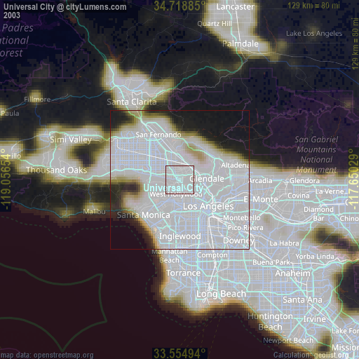
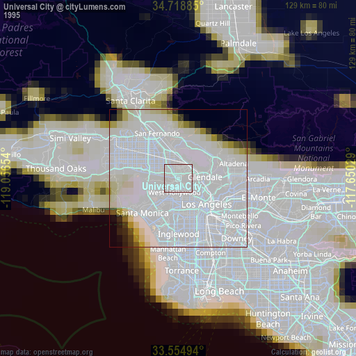
» NASA, Earths city lights 1995
» NASA city lights 2003
» Earth at Night: Flat Maps 2012, 2016