Hollywood night lights from space
Night Light of Hollywood (California) from space (United States) Src. Average luminocity for 10x10km area is 94.1447% and for 50x50km: 73.4659%.
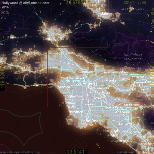
Analysis of Hollywood night lights 2016
Square area 10x10 km:
 60.26%
90-99
12.27%80-89
16.3%70-79
10.99%60-69
0.18%50-59
0%40-49
0%30-39
0%20-29
0%10-19
0%0-9
0%Square area 50x50 km:
39.09%90-99
16.7%80-89
5.61%70-79
5.41%60-69
6.41%50-59
3.4%40-49
2.27%30-39
2.23%20-29
3.06%10-19
4.22%0-9
11.6%Clear (daylight) street map image can be seen on geolist.org.
Map coordinates:
34° 40' 42.9" North, 119° 1' 47.5" West
34° 5' 54" North, 118° 19' 36.3" West
33° 30' 50.8" North, 117° 37' 25" West
Some cities around Hollywood sort by population:
• Glendale
8.2 km =5.1 mi,  53°
53°
• Koreatown
5.1 km =3.2 mi,  152°
152°
• Universal City
5.1 km =3.2 mi,  331°
331°
• Echo Park
6.5 km =4 mi,  110°
110°
• West Hollywood
3.4 km =2.1 mi,  253°
253°
• Beverly Hills
7.3 km =4.5 mi, 247°
• Studio City
8.5 km =5.3 mi,  311°
311°
• Silver Lake
5.4 km =3.4 mi,  103°
103°
5357527 (p: 167,664)
Sources (retrieved 2019-11-25):
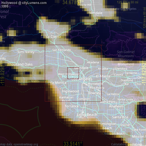
» NASA, Earths city lights 1995
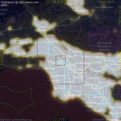
» NASA city lights 2003
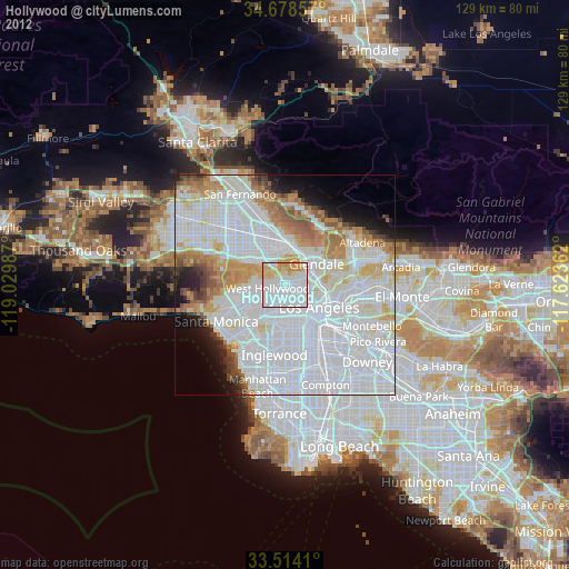
» Earth at Night: Flat Maps 2012, 2016