Beverly Hills night lights from space
Night Light of Beverly Hills (California) from space (United States) Src. Average luminocity for 10x10km area is 95.2902% and for 50x50km: 69.314%.
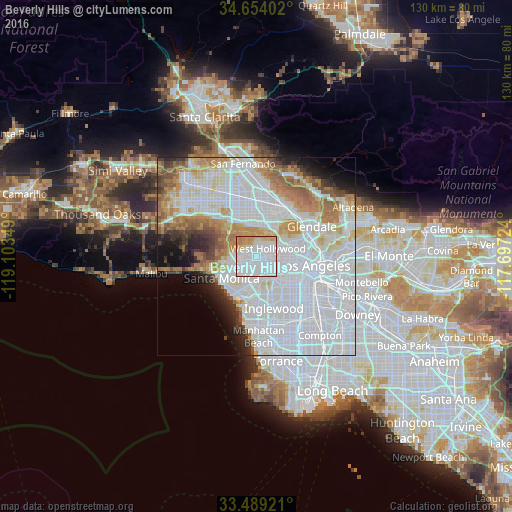
Analysis of Beverly Hills night lights 2016
Square area 10x10 km:
 69.58%
90-99
11.19%80-89
7.17%70-79
9.44%60-69
2.62%50-59
0%40-49
0%30-39
0%20-29
0%10-19
0%0-9
0%Square area 50x50 km:
36.99%90-99
14.33%80-89
4.74%70-79
5.41%60-69
7.07%50-59
3.79%40-49
2.44%30-39
2.7%20-29
3.21%10-19
4.66%0-9
14.67%Clear (daylight) street map image can be seen on geolist.org.
Map coordinates:
34° 39' 14.5" North, 119° 6' 12.6" West
34° 4' 25" North, 118° 24' 1.3" West
33° 29' 21.2" North, 117° 41' 50.1" West
Some cities around Beverly Hills sort by population:
• Hollywood
7.3 km =4.5 mi,  67°
67°
• Koreatown
9.3 km =5.8 mi,  100°
100°
• Universal City
8.4 km =5.2 mi,  30°
30°
• Culver City
5.8 km =3.6 mi,  176°
176°
• West Hollywood
4 km =2.5 mi,  62°
62°
• Studio City
8.3 km =5.2 mi,  2°
2°
• Ladera Heights
9.1 km =5.7 mi,  165°
165°
• Century City
2.6 km =1.6 mi,  218°
218°
5328041 (p: 34,869)
Sources (retrieved 2019-11-25):
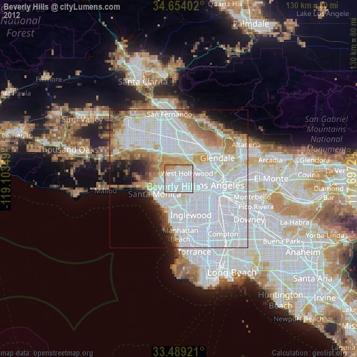
» Earth at Night: Flat Maps 2012, 2016