Burbank night lights from space
Night Light of Burbank (California) from space (United States) Src. Average luminocity for 10x10km area is 85.2985% and for 50x50km: 63.7889%.
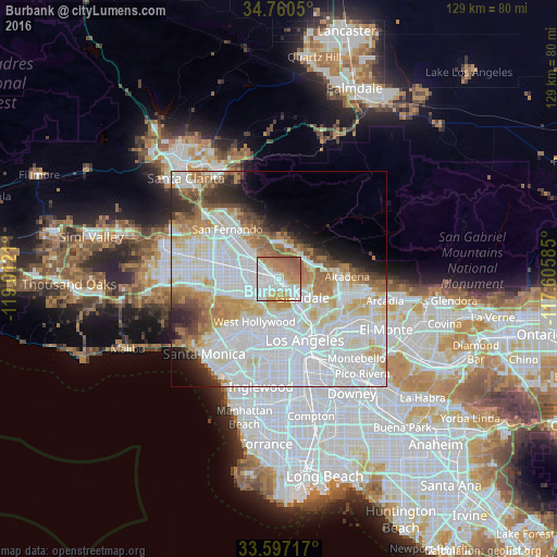

Analysis of Burbank night lights 2016
Square area 10x10 km:
 33.88%
90-99
19.6%80-89
6.59%70-79
15.93%60-69
17.03%50-59
6.96%40-49
0%30-39
0%20-29
0%10-19
0%0-9
0%Square area 50x50 km:
28.56%90-99
15.68%80-89
5.94%70-79
5.55%60-69
7.25%50-59
3.98%40-49
2.79%30-39
2.94%20-29
3.55%10-19
4.25%0-9
19.52%Clear (daylight) street map image can be seen on geolist.org.
Map coordinates:
34° 45' 37.8" North, 119° 0' 43.6" West
34° 10' 51" North, 118° 18' 32.3" West
33° 35' 49.8" North, 117° 36' 21.1" West
Some cities around Burbank sort by population:
• Glendale
6.5 km =4 mi,  130°
130°
• Hollywood
9.3 km =5.8 mi,  190°
190°
• Universal City
6.2 km =3.9 mi,  221°
221°
• North Hollywood
6.5 km =4 mi,  261°
261°
• Studio City
8.8 km =5.5 mi,  246°
246°
• Tujunga
8.2 km =5.1 mi,  13°
13°
• La Crescenta-Montrose
8.9 km =5.5 mi,  49°
49°
• Sunland
9.6 km =6 mi,  3°
3°
5331835 (p: 105,319)
Sources (retrieved 2019-11-25):
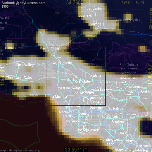
» NASA, Earths city lights 1995
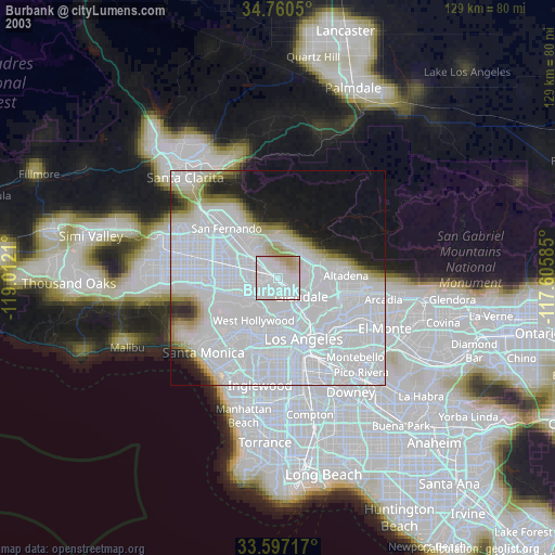
» NASA city lights 2003
» Earth at Night: Flat Maps 2012, 2016