Sherman Oaks night lights from space
Night Light of Sherman Oaks (California) from space (United States) Src. Average luminocity for 10x10km area is 85.3535% and for 50x50km: 60.8129%.
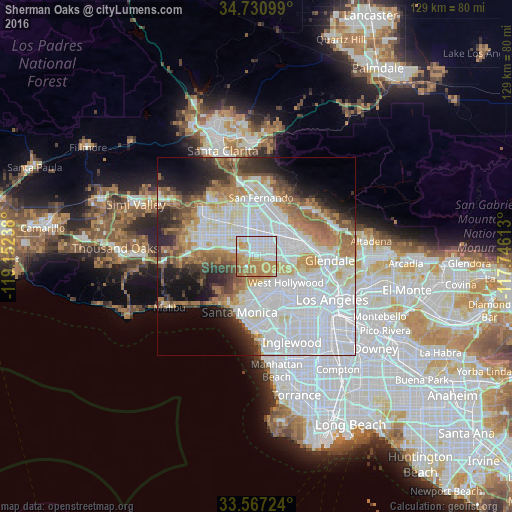

Analysis of Sherman Oaks night lights 2016
Square area 10x10 km:
 29.67%
90-99
18.5%80-89
7.33%70-79
29.3%60-69
13.19%50-59
2.01%40-49
0%30-39
0%20-29
0%10-19
0%0-9
0%Square area 50x50 km:
26.96%90-99
11.9%80-89
4.66%70-79
5.61%60-69
8.27%50-59
5.12%40-49
3.82%30-39
4.39%20-29
5.65%10-19
7.46%0-9
16.16%Clear (daylight) street map image can be seen on geolist.org.
Map coordinates:
34° 43' 51.6" North, 119° 9' 8.6" West
34° 9' 4" North, 118° 26' 57.3" West
33° 34' 2.1" North, 117° 44' 46.1" West
Some cities around Sherman Oaks sort by population:
• Van Nuys
4 km =2.5 mi,  0°
0°
• Universal City
8.9 km =5.5 mi,  98°
98°
• North Hollywood
6.9 km =4.3 mi,  70°
70°
• Valley Glen
4.3 km =2.7 mi,  359°
359°
• North Hills
10 km =6.2 mi,  341°
341°
• Encino
4.9 km =3 mi,  280°
280°
• Beverly Hills
9.7 km =6 mi,  152°
152°
• Studio City
4.9 km =3 mi,  93°
93°
5395244 (p: 52,677)
Sources (retrieved 2019-11-25):
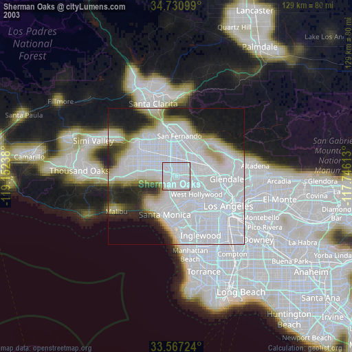
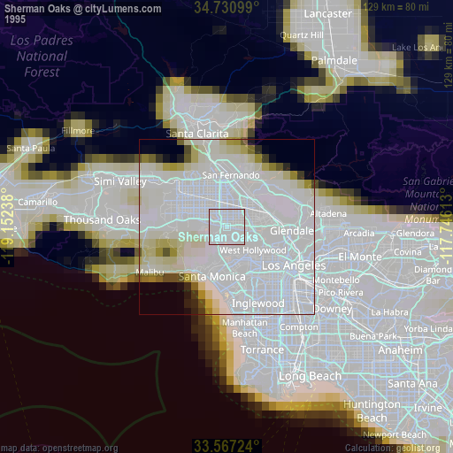
» NASA, Earths city lights 1995
» NASA city lights 2003
» Earth at Night: Flat Maps 2012, 2016