Studio City night lights from space
Night Light of Studio City (California) from space (United States) Src. Average luminocity for 10x10km area is 91.6282% and for 50x50km: 64.2895%.
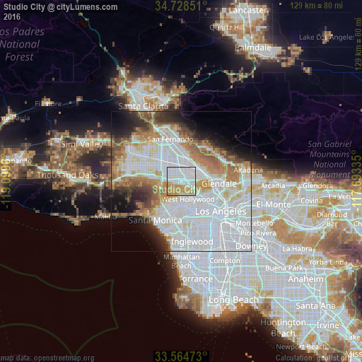
Analysis of Studio City night lights 2016
Square area 10x10 km:
 45.05%
90-99
19.78%80-89
13.19%70-79
19.41%60-69
2.56%50-59
0%40-49
0%30-39
0%20-29
0%10-19
0%0-9
0%Square area 50x50 km:
30.03%90-99
13.7%80-89
4.97%70-79
5.64%60-69
7.83%50-59
4.59%40-49
3.13%30-39
3.65%20-29
4.41%10-19
6.38%0-9
15.66%Clear (daylight) street map image can be seen on geolist.org.
Map coordinates:
34° 43' 42.6" North, 119° 5' 58.6" West
34° 8' 55" North, 118° 23' 47.3" West
33° 33' 53" North, 117° 41' 36.1" West
Some cities around Studio City sort by population:
• Hollywood
8.5 km =5.3 mi,  131°
131°
• Van Nuys
6.4 km =4 mi,  311°
311°
• Universal City
4.1 km =2.5 mi,  105°
105°
• North Hollywood
3.1 km =1.9 mi,  31°
31°
• Valley Glen
6.7 km =4.2 mi, 313°
• Sherman Oaks
4.9 km =3 mi,  273°
273°
• West Hollywood
7.3 km =4.5 mi,  153°
153°
• Beverly Hills
8.3 km =5.2 mi,  182°
182°
5399438 (p: 34,034)
Sources (retrieved 2019-11-25):
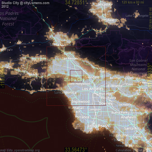
» Earth at Night: Flat Maps 2012, 2016