Union night lights from space
Night Light of Union (New Jersey) from space (United States) Src. Average luminocity for 10x10km area is 96.9708% and for 50x50km: 79.1146%.
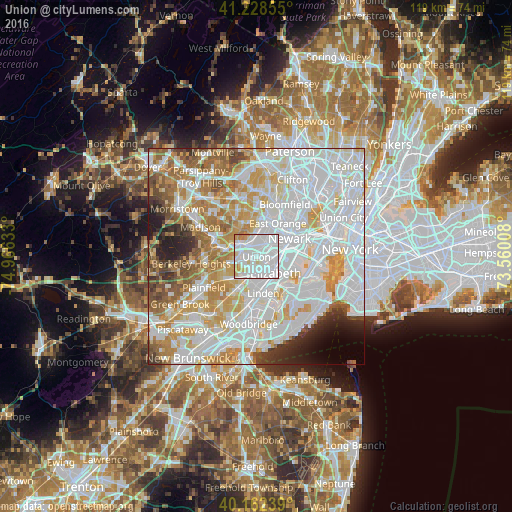
Analysis of Union night lights 2016
Square area 10x10 km:
 61.53%
90-99
26.79%80-89
5.84%70-79
4.06%60-69
1.79%50-59
0%40-49
0%30-39
0%20-29
0%10-19
0%0-9
0%Square area 50x50 km:
33.64%90-99
20.18%80-89
8.2%70-79
10.08%60-69
7.56%50-59
4.93%40-49
3.35%30-39
2.77%20-29
3.61%10-19
2.61%0-9
3.08%Clear (daylight) street map image can be seen on geolist.org.
Map coordinates:
41° 13' 42.8" North, 74° 57' 58.8" West
40° 41' 51.4" North, 74° 15' 47.5" West
40° 9' 44.6" North, 73° 33' 36.3" West
Some cities around Union sort by population:
• Irvington
4.5 km =2.8 mi,  31°
31°
• Maplewood
3.8 km =2.4 mi,  346°
346°
• Cranford
5.3 km =3.3 mi,  215°
215°
• Hillside
2.8 km =1.7 mi,  81°
81°
• Roselle
5.1 km =3.2 mi,  175°
175°
• Springfield
4.6 km =2.9 mi,  280°
280°
• Roselle Park
3.7 km =2.3 mi, 181°
• Kenilworth
3.3 km =2.1 mi, 224°
5105608 (p: 56,771)
Sources (retrieved 2019-11-25):
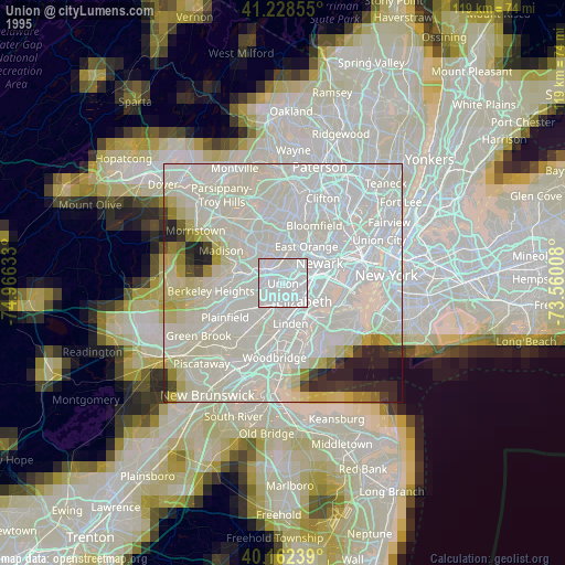
» NASA, Earths city lights 1995
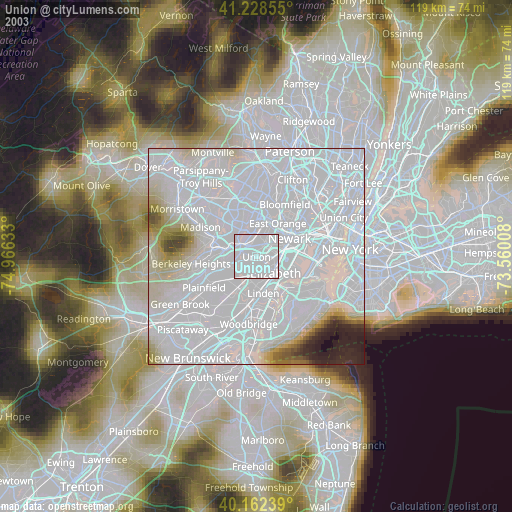
» NASA city lights 2003
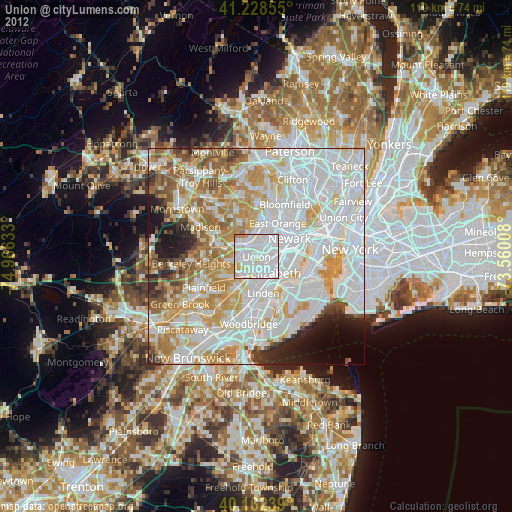
» Earth at Night: Flat Maps 2012, 2016