Kenilworth night lights from space
Night Light of Kenilworth (New Jersey) from space (United States) Src. Average luminocity for 10x10km area is 93.9026% and for 50x50km: 76.7412%.
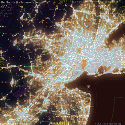
Analysis of Kenilworth night lights 2016
Square area 10x10 km:
 43.51%
90-99
30.03%80-89
13.96%70-79
9.74%60-69
2.76%50-59
0%40-49
0%30-39
0%20-29
0%10-19
0%0-9
0%Square area 50x50 km:
30.58%90-99
19.18%80-89
8.26%70-79
10.41%60-69
8.12%50-59
5.17%40-49
3.91%30-39
3.72%20-29
4.36%10-19
3.46%0-9
2.84%Clear (daylight) street map image can be seen on geolist.org.
Map coordinates:
41° 12' 27.4" North, 74° 59' 37.8" West
40° 40' 35.4" North, 74° 17' 26.5" West
40° 8' 28" North, 73° 35' 15.3" West
Some cities around Kenilworth sort by population:
• Union
3.3 km =2.1 mi,  44°
44°
• Westfield
5.2 km =3.2 mi,  247°
247°
• Cranford
2.1 km =1.3 mi,  200°
200°
• Roselle
3.8 km =2.4 mi,  135°
135°
• Clark
4.3 km =2.7 mi, 203°
• Springfield
3.9 km =2.4 mi,  324°
324°
• Roselle Park
2.6 km =1.6 mi,  120°
120°
• Mountainside
5.6 km =3.5 mi,  265°
265°
5100007 (p: 8,215)
Sources (retrieved 2019-11-25):
» Earth at Night: Flat Maps 2012, 2016