Roselle Park night lights from space
Night Light of Roselle Park (New Jersey) from space (United States) Src. Average luminocity for 10x10km area is 97.6282% and for 50x50km: 77.2919%.
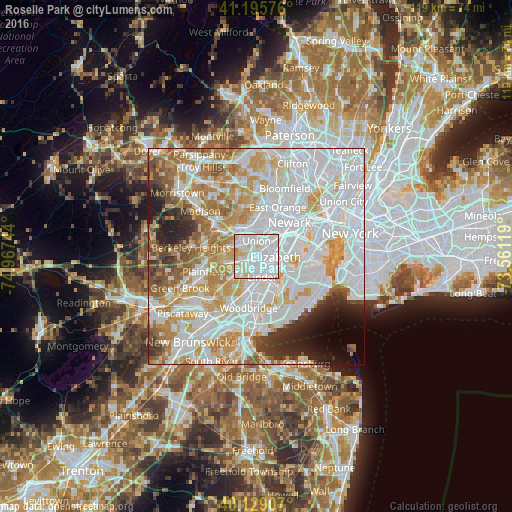
Analysis of Roselle Park night lights 2016
Square area 10x10 km:
 61.53%
90-99
27.76%80-89
8.93%70-79
1.62%60-69
0.16%50-59
0%40-49
0%30-39
0%20-29
0%10-19
0%0-9
0%Square area 50x50 km:
32.32%90-99
19.49%80-89
8.24%70-79
10.13%60-69
7.67%50-59
4.45%40-49
3.01%30-39
3.2%20-29
4.26%10-19
3.33%0-9
3.9%Clear (daylight) street map image can be seen on geolist.org.
Map coordinates:
41° 11' 44.7" North, 74° 58' 2.8" West
40° 39' 52.4" North, 74° 15' 51.5" West
40° 7' 44.7" North, 73° 33' 40.3" West
Some cities around Roselle Park sort by population:
• Elizabeth
4.5 km =2.8 mi,  90°
90°
• Union
3.7 km =2.3 mi,  1°
1°
• Linden
5 km =3.1 mi,  160°
160°
• Cranford
3.1 km =1.9 mi,  257°
257°
• Hillside
5 km =3.1 mi,  35°
35°
• Clark
4.7 km =2.9 mi,  236°
236°
• Springfield
6.3 km =3.9 mi,  315°
315°
• Kenilworth
2.6 km =1.6 mi,  300°
300°
5103503 (p: 13,670)
Sources (retrieved 2019-11-25):
» Earth at Night: Flat Maps 2012, 2016