Tyrone night lights from space
Night Light of Tyrone (Pennsylvania) from space (United States) Src. Average luminocity for 10x10km area is 8.3523% and for 50x50km: 4.6457%.
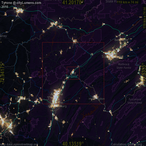
Analysis of Tyrone night lights 2016
Square area 10x10 km:
 0.81%
0.81%90-99
0.65%80-89
1.14%70-79
1.14%60-69
2.11%50-59
0.65%40-49
1.62%30-39
1.62%20-29
0.81%10-19
1.62%0-9
87.82%Square area 50x50 km:
0.68%90-99
0.76%80-89
0.63%70-79
0.32%60-69
0.55%50-59
0.53%40-49
0.61%30-39
0.85%20-29
1.43%10-19
2.41%0-9
91.22%Clear (daylight) street map image can be seen on geolist.org.
Map coordinates:
41° 12' 6.4" North, 78° 56' 30.3" West
40° 40' 14.2" North, 78° 14' 19" West
40° 8' 6.7" North, 77° 32' 7.8" West
Some cities around Tyrone sort by population:
• Altoona
21.4 km =13.3 mi,  217°
217°
• State College
34.7 km =21.6 mi,  66°
66°
• Shiloh
41.5 km =25.8 mi,  353°
353°
• Park Forest Village
31 km =19.3 mi,  60°
60°
• Huntingdon
28.3 km =17.6 mi,  136°
136°
• Bellefonte
47.2 km =29.3 mi, 55°
• Clearfield
43.1 km =26.8 mi,  336°
336°
• Hollidaysburg
29.9 km =18.6 mi,  205°
205°
5216514 (p: 5,353)
Sources (retrieved 2019-11-25):
» Earth at Night: Flat Maps 2012, 2016