Huntingdon night lights from space
Night Light of Huntingdon (Pennsylvania) from space (United States) Src. Average luminocity for 10x10km area is 13.1701% and for 50x50km: 1.327%.
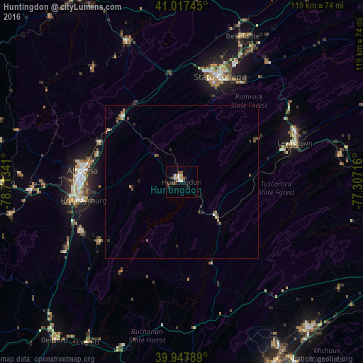
Analysis of Huntingdon night lights 2016
Square area 10x10 km:
 2.21%
2.21%90-99
2.55%80-89
0.68%70-79
0.68%60-69
0.68%50-59
3.23%40-49
1.7%30-39
2.72%20-29
2.55%10-19
0.68%0-9
82.31%Square area 50x50 km:
0.14%90-99
0.13%80-89
0.1%70-79
0.12%60-69
0.19%50-59
0.27%40-49
0.32%30-39
0.28%20-29
0.3%10-19
0.12%0-9
98.04%Clear (daylight) street map image can be seen on geolist.org.
Map coordinates:
41° 1' 2.8" North, 78° 42' 48.3" West
40° 29' 5.3" North, 78° 0' 37" West
39° 56' 52.4" North, 77° 18' 25.8" West
Some cities around Huntingdon sort by population:
• Altoona
32.7 km =20.3 mi,  276°
276°
• State College
36.6 km =22.7 mi,  20°
20°
• Park Forest Village
36.7 km =22.8 mi,  12°
12°
• Lewistown
39.2 km =24.4 mi,  71°
71°
• Bellefonte
51.5 km =32 mi, 22°
• Hollidaysburg
32.7 km =20.3 mi,  258°
258°
• Shippensburg
63.7 km =39.6 mi,  139°
139°
• Tyrone
28.3 km =17.6 mi,  316°
316°
5194590 (p: 7,029)
Sources (retrieved 2019-11-25):
» Earth at Night: Flat Maps 2012, 2016