Shiloh night lights from space
Night Light of Shiloh (Pennsylvania) from space (United States) Src. Average luminocity for 10x10km area is 1.2517% and for 50x50km: 1.7135%.
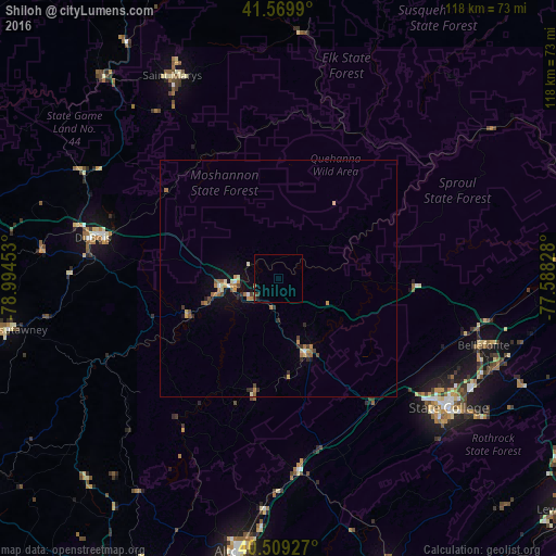
Analysis of Shiloh night lights 2016
Square area 10x10 km:
 0%
0%90-99
0%80-89
0%70-79
0%60-69
0%50-59
0.51%40-49
0.51%30-39
0.68%20-29
0%10-19
0.68%0-9
97.62%Square area 50x50 km:
0.09%90-99
0.16%80-89
0.16%70-79
0.36%60-69
0.4%50-59
0.24%40-49
0.24%30-39
0.28%20-29
0.22%10-19
0.61%0-9
97.25%Clear (daylight) street map image can be seen on geolist.org.
Map coordinates:
41° 34' 11.6" North, 78° 59' 40.3" West
41° 2' 30.2" North, 78° 17' 29" West
40° 30' 33.4" North, 77° 35' 17.8" West
Some cities around Shiloh sort by population:
• State College
45.6 km =28.3 mi,  127°
127°
• Saint Marys
48.5 km =30.1 mi,  332°
332°
• Park Forest Village
40.9 km =25.4 mi, 129°
• DuBois
40.2 km =25 mi,  282°
282°
• Bellefonte
45.4 km =28.2 mi,  108°
108°
• Clearfield
12.5 km =7.8 mi,  262°
262°
• Punxsutawney
58.1 km =36.1 mi, 259°
• Tyrone
41.5 km =25.8 mi,  173°
173°
5211957 (p: 11,217)
Sources (retrieved 2019-11-25):
» Earth at Night: Flat Maps 2012, 2016