Bellefonte night lights from space
Night Light of Bellefonte (Pennsylvania) from space (United States) Src. Average luminocity for 10x10km area is 21.2313% and for 50x50km: 5.0596%.
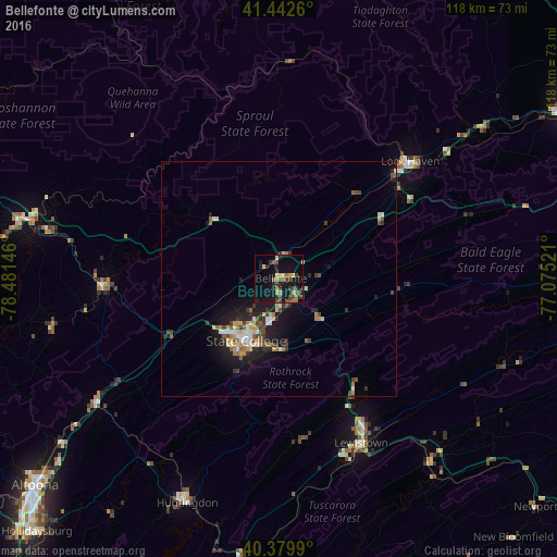
Analysis of Bellefonte night lights 2016
Square area 10x10 km:
 0%
0%90-99
0.17%80-89
5.27%70-79
2.21%60-69
3.06%50-59
2.72%40-49
6.12%30-39
5.27%20-29
4.59%10-19
27.04%0-9
43.54%Square area 50x50 km:
0.47%90-99
0.5%80-89
0.75%70-79
0.55%60-69
0.66%50-59
0.64%40-49
1.01%30-39
0.97%20-29
1.33%10-19
4.45%0-9
88.67%Clear (daylight) street map image can be seen on geolist.org.
Map coordinates:
41° 26' 33.4" North, 78° 28' 53.3" West
40° 54' 48.2" North, 77° 46' 42" West
40° 22' 47.6" North, 77° 4' 30.8" West
Some cities around Bellefonte sort by population:
• State College
15 km =9.3 mi,  207°
207°
• Shiloh
45.4 km =28.2 mi,  288°
288°
• Park Forest Village
16.6 km =10.3 mi,  224°
224°
• Lock Haven
37.3 km =23.2 mi,  48°
48°
• Lewistown
39 km =24.2 mi,  153°
153°
• Huntingdon
51.5 km =32 mi,  202°
202°
• Clearfield
56.9 km =35.4 mi,  282°
282°
• Tyrone
47.2 km =29.3 mi,  235°
235°
5179799 (p: 6,248)
Sources (retrieved 2019-11-25):
» Earth at Night: Flat Maps 2012, 2016