Tuckahoe night lights from space
Night Light of Tuckahoe (New York) from space (United States) Src. Average luminocity for 10x10km area is 91.4031% and for 50x50km: 70.5565%.
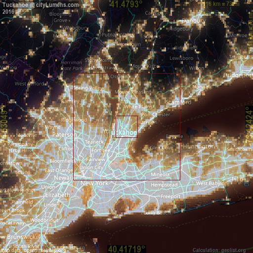
Analysis of Tuckahoe night lights 2016
Square area 10x10 km:
 38.78%
90-99
29.08%80-89
9.69%70-79
15.48%60-69
6.63%50-59
0.34%40-49
0%30-39
0%20-29
0%10-19
0%0-9
0%Square area 50x50 km:
24.99%90-99
15.16%80-89
7.03%70-79
9.21%60-69
12.57%50-59
7.33%40-49
4.61%30-39
4.6%20-29
5.72%10-19
5.12%0-9
3.66%Clear (daylight) street map image can be seen on geolist.org.
Map coordinates:
41° 28' 45.5" North, 74° 31' 49.8" West
40° 57' 1.4" North, 73° 49' 38.5" West
40° 25' 1.9" North, 73° 7' 27.3" West
Some cities around Tuckahoe sort by population:
• New Rochelle
5.7 km =3.5 mi,  138°
138°
• Mount Vernon
4.3 km =2.7 mi,  190°
190°
• Wakefield
6.2 km =3.9 mi,  199°
199°
• Eastchester
1.8 km =1.1 mi,  60°
60°
• Wykagyl
2.6 km =1.6 mi,  112°
112°
• Greenville
4.8 km =3 mi,  7°
7°
• Pelham
4.8 km =3 mi,  160°
160°
• Bronxville
1.4 km =0.9 mi, 196°
5141528 (p: 6,643)
Sources (retrieved 2019-11-25):
» Earth at Night: Flat Maps 2012, 2016