Trooper night lights from space
Night Light of Trooper (Pennsylvania) from space (United States) Src. Average luminocity for 10x10km area is 67.4026% and for 50x50km: 60.6157%.
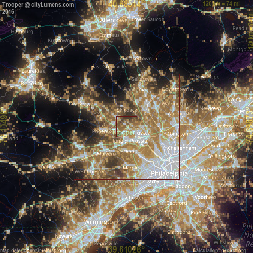
Analysis of Trooper night lights 2016
Square area 10x10 km:
 8.28%
8.28%90-99
8.28%80-89
13.8%70-79
14.77%60-69
15.1%50-59
21.43%40-49
9.42%30-39
8.6%20-29
0.32%10-19
0%0-9
0%Square area 50x50 km:
14.25%90-99
9.4%80-89
8.27%70-79
9.89%60-69
13.7%50-59
10.55%40-49
7.3%30-39
6.51%20-29
5.91%10-19
7.51%0-9
6.71%Clear (daylight) street map image can be seen on geolist.org.
Map coordinates:
40° 41' 6.5" North, 76° 6' 17.9" West
40° 8' 59.4" North, 75° 24' 6.7" West
39° 36' 36.9" North, 74° 41' 55.4" West
Some cities around Trooper sort by population:
• Norristown
6.1 km =3.8 mi,  120°
120°
• King of Prussia
6.8 km =4.2 mi,  175°
175°
• Phoenixville
9.9 km =6.2 mi,  257°
257°
• West Norriton
3 km =1.9 mi,  138°
138°
• Audubon
3.5 km =2.2 mi,  226°
226°
• Conshohocken
11.6 km =7.2 mi,  132°
132°
• Blue Bell
11.5 km =7.1 mi,  88°
88°
• Collegeville
5.8 km =3.6 mi,  313°
313°
5216092 (p: 5,744)
Sources (retrieved 2019-11-25):
» Earth at Night: Flat Maps 2012, 2016