Traverse City night lights from space
Night Light of Traverse City (Michigan) from space (United States) Src. Average luminocity for 10x10km area is 43.503% and for 50x50km: 3.1319%.
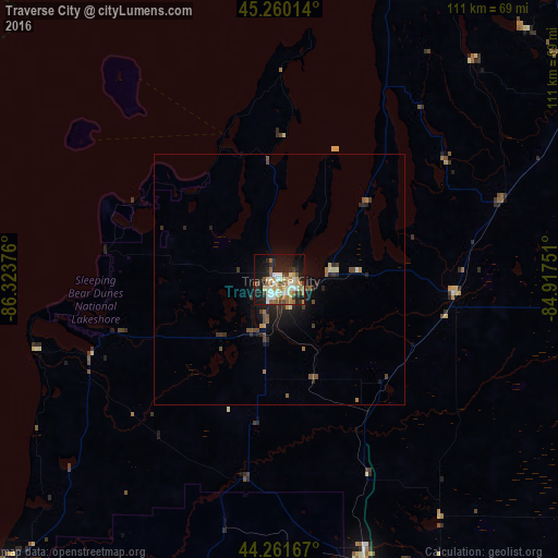
Analysis of Traverse City night lights 2016
Square area 10x10 km:
 5.61%
5.61%90-99
10%80-89
6.52%70-79
5.91%60-69
6.97%50-59
6.36%40-49
3.03%30-39
4.39%20-29
11.97%10-19
28.18%0-9
11.06%Square area 50x50 km:
0.24%90-99
0.44%80-89
0.36%70-79
0.33%60-69
0.52%50-59
0.43%40-49
0.58%30-39
0.48%20-29
1.07%10-19
2.41%0-9
93.14%Clear (daylight) street map image can be seen on geolist.org.
Map coordinates:
45° 15' 36.5" North, 86° 19' 25.5" West
44° 45' 47" North, 85° 37' 14.3" West
44° 15' 42" North, 84° 55' 3" West
Some cities around Traverse City sort by population:
• Mount Pleasant
146.3 km =90.9 mi,  152°
152°
• Big Rapids
118.9 km =73.9 mi,  174°
174°
• Cadillac
59.4 km =36.9 mi,  162°
162°
• Sturgeon Bay
138.8 km =86.2 mi,  273°
273°
• Ludington
111.5 km =69.3 mi,  216°
216°
• Manistee
80.2 km =49.8 mi, 224°
• Bay Harbor
79.1 km =49.2 mi,  32°
32°
• Petoskey
85.6 km =53.2 mi,  37°
37°
5012495 (p: 15,218)
Sources (retrieved 2019-11-25):
» Earth at Night: Flat Maps 2012, 2016