Bay Harbor night lights from space
Night Light of Bay Harbor (Michigan) from space (United States) Src. Average luminocity for 10x10km area is 1.0238% and for 50x50km: 1.5623%.
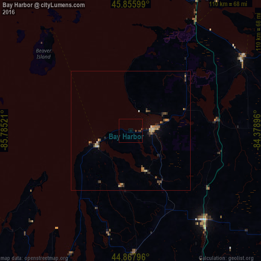
Analysis of Bay Harbor night lights 2016
Square area 10x10 km:
 0%
0%90-99
0%80-89
0%70-79
0%60-69
0%50-59
0%40-49
0.95%30-39
0.63%20-29
0.63%10-19
0%0-9
97.78%Square area 50x50 km:
0.03%90-99
0.11%80-89
0.32%70-79
0.18%60-69
0.29%50-59
0.23%40-49
0.34%30-39
0.33%20-29
0.47%10-19
0.14%0-9
97.55%Clear (daylight) street map image can be seen on geolist.org.
Map coordinates:
45° 51' 21.6" North, 85° 47' 6.8" West
45° 21' 50.9" North, 85° 4' 55.5" West
44° 52' 4.7" North, 84° 22' 44.3" West
Some cities around Bay Harbor sort by population:
• Sault Ste. Marie, CA
140.6 km =87.4 mi,  24°
24°
• Traverse City
79.1 km =49.2 mi,  212°
212°
• Sault Ste. Marie
138.1 km =85.8 mi, 24°
• Escanaba
160.1 km =99.5 mi,  285°
285°
• Cadillac
126.2 km =78.4 mi,  191°
191°
• Alpena
133.5 km =83 mi,  104°
104°
• Manistee
158.4 km =98.4 mi,  218°
218°
• Petoskey
10 km =6.2 mi,  84°
84°
11669119 (p: 5,749)
Sources (retrieved 2019-11-25):
» Earth at Night: Flat Maps 2012, 2016