Tell City night lights from space
Night Light of Tell City (Indiana) from space (United States) Src. Average luminocity for 10x10km area is 25.2597% and for 50x50km: 4.2244%.
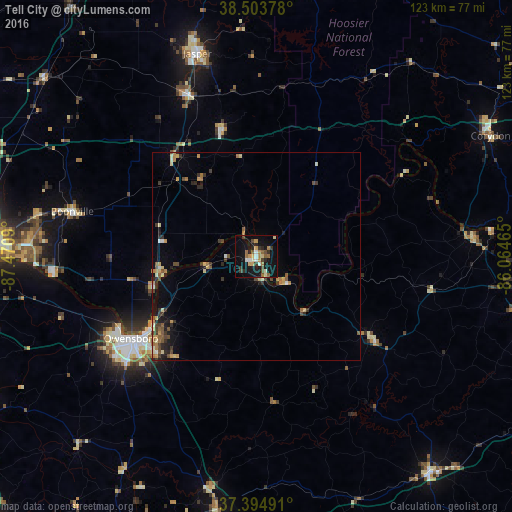
Analysis of Tell City night lights 2016
Square area 10x10 km:
 2.11%
2.11%90-99
3.08%80-89
2.6%70-79
4.06%60-69
3.41%50-59
4.71%40-49
3.41%30-39
3.9%20-29
3.9%10-19
32.63%0-9
36.2%Square area 50x50 km:
0.2%90-99
0.36%80-89
0.6%70-79
0.63%60-69
0.68%50-59
0.7%40-49
0.71%30-39
0.96%20-29
0.83%10-19
2.49%0-9
91.83%Clear (daylight) street map image can be seen on geolist.org.
Map coordinates:
38° 30' 13.6" North, 87° 28' 15.2" West
37° 57' 5.2" North, 86° 46' 4" West
37° 23' 41.7" North, 86° 3' 52.7" West
Some cities around Tell City sort by population:
• Evansville
69.1 km =42.9 mi,  272°
272°
• Owensboro
36.2 km =22.5 mi,  236°
236°
• Jasper
51 km =31.7 mi,  343°
343°
• Oak Grove
67.5 km =41.9 mi,  179°
179°
• Leitchfield
67 km =41.6 mi,  141°
141°
• Knottsville
23.3 km =14.5 mi,  210°
210°
• Boonville
45.7 km =28.4 mi,  283°
283°
• Huntingburg
42 km =26.1 mi, 337°
4265717 (p: 7,255)
Sources (retrieved 2019-11-25):
» Earth at Night: Flat Maps 2012, 2016