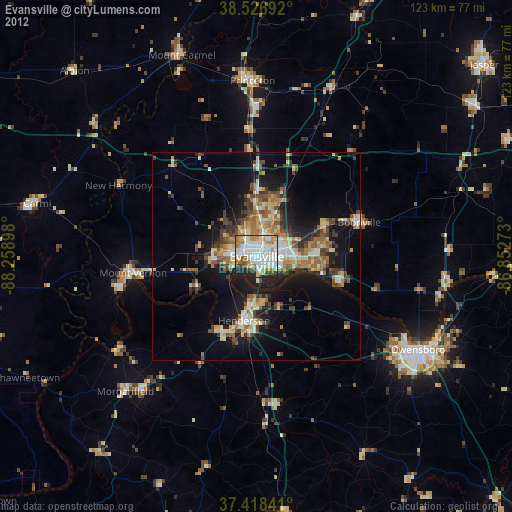
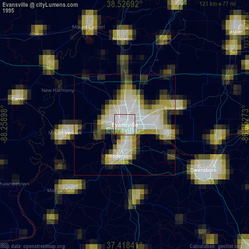
Evansville night lights from space
Night Light of Evansville (Indiana) from space (United States) Src. Average luminocity for 10x10km area is 78.5455% and for 50x50km: 17.3229%.


Analysis of Evansville night lights 2016
Square area 10x10 km:
 32.14%
90-99
24.35%80-89
4.55%70-79
7.47%60-69
5.68%50-59
4.22%40-49
6.49%30-39
6.01%20-29
8.6%10-19
0.49%0-9
0%Square area 50x50 km:
2.58%90-99
2.64%80-89
1.65%70-79
2.07%60-69
1.97%50-59
3.11%40-49
2.91%30-39
3.45%20-29
4.78%10-19
11.06%0-9
63.79%Clear (daylight) street map image can be seen on geolist.org.
Map coordinates:
38° 31' 36.9" North, 88° 15' 32.3" West
37° 58' 29.1" North, 87° 33' 21.1" West
37° 25' 6.3" North, 86° 51' 9.8" West
Some cities around Evansville sort by population:
• Owensboro
44.8 km =27.8 mi,  119°
119°
• Henderson
15.7 km =9.8 mi,  191°
191°
• Princeton
42.3 km =26.3 mi,  358°
358°
• Mount Carmel
51.7 km =32.1 mi,  339°
339°
• Mount Vernon
30.1 km =18.7 mi,  260°
260°
• Knottsville
61.5 km =38.2 mi,  111°
111°
• Boonville
26 km =16.2 mi,  71°
71°
• Carmi
54.3 km =33.7 mi,  283°
283°
4257227 (p: 119,943)
Sources (retrieved 2019-11-25):
» NASA, Earths city lights 1995
» NASA city lights 2003
» Earth at Night: Flat Maps 2012, 2016