Knottsville night lights from space
Night Light of Knottsville (Kentucky) from space (United States) Src. Average luminocity for 10x10km area is 0.0935% and for 50x50km: 8.0937%.
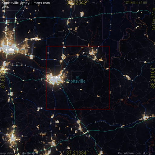
Analysis of Knottsville night lights 2016
Square area 10x10 km:
 0%
0%90-99
0%80-89
0%70-79
0%60-69
0%50-59
0%40-49
0%30-39
0%20-29
0%10-19
0%0-9
100%Square area 50x50 km:
1.2%90-99
1.32%80-89
1.04%70-79
0.92%60-69
0.9%50-59
1.08%40-49
1.1%30-39
1.33%20-29
2.05%10-19
4.75%0-9
84.3%Clear (daylight) street map image can be seen on geolist.org.
Map coordinates:
38° 19' 31.5" North, 87° 36' 26.2" West
37° 46' 18.2" North, 86° 54' 15" West
37° 12' 49.8" North, 86° 12' 3.7" West
Some cities around Knottsville sort by population:
• Owensboro
18.4 km =11.4 mi,  270°
270°
• Henderson
60.7 km =37.7 mi,  276°
276°
• Oak Grove
49.3 km =30.6 mi,  164°
164°
• Morehead
60.6 km =37.7 mi,  203°
203°
• Tell City
23.3 km =14.5 mi,  30°
30°
• Boonville
44.8 km =27.8 mi,  313°
313°
• Huntingburg
58.8 km =36.5 mi,  355°
355°
• Central City
56.5 km =35.1 mi, 199°
4297184 (p: 6,270)
Sources (retrieved 2019-11-25):
» Earth at Night: Flat Maps 2012, 2016