Swansea night lights from space
Night Light of Swansea (Illinois) from space (United States) Src. Average luminocity for 10x10km area is 85.4968% and for 50x50km: 40.4361%.
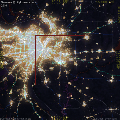
Analysis of Swansea night lights 2016
Square area 10x10 km:
 26.95%
90-99
27.27%80-89
13.15%70-79
15.91%60-69
6.33%50-59
5.19%40-49
3.08%30-39
1.3%20-29
0.81%10-19
0%0-9
0%Square area 50x50 km:
9.5%90-99
8.19%80-89
5.31%70-79
5.62%60-69
6.44%50-59
6.01%40-49
4.1%30-39
4.53%20-29
5.05%10-19
9.51%0-9
35.74%Clear (daylight) street map image can be seen on geolist.org.
Map coordinates:
39° 4' 54.7" North, 90° 41' 31.6" West
38° 32' 2.2" North, 89° 59' 20.4" West
37° 58' 54.6" North, 89° 17' 9.1" West
Some cities around Swansea sort by population:
• Belleville
1.6 km =1 mi,  164°
164°
• O'Fallon
9.4 km =5.8 mi,  46°
46°
• East Saint Louis
17.3 km =10.7 mi,  305°
305°
• Collinsville
15.2 km =9.4 mi,  1°
1°
• Fairview Heights
6.1 km =3.8 mi,  358°
358°
• Shiloh
8.5 km =5.3 mi,  69°
69°
• Mascoutah
17.7 km =11 mi,  105°
105°
• Centreville
13 km =8.1 mi,  294°
294°
4251003 (p: 13,543)
Sources (retrieved 2019-11-25):
» Earth at Night: Flat Maps 2012, 2016