Swainsboro night lights from space
Night Light of Swainsboro (Georgia) from space (United States) Src. Average luminocity for 10x10km area is 37.3916% and for 50x50km: 3.0591%.
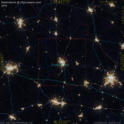
Analysis of Swainsboro night lights 2016
Square area 10x10 km:
 4.02%
4.02%90-99
5.77%80-89
1.92%70-79
11.54%60-69
7.52%50-59
2.8%40-49
3.67%30-39
7.17%20-29
3.15%10-19
40.03%0-9
12.41%Square area 50x50 km:
0.22%90-99
0.3%80-89
0.2%70-79
0.67%60-69
0.72%50-59
0.34%40-49
0.4%30-39
0.65%20-29
0.28%10-19
2.38%0-9
93.83%Clear (daylight) street map image can be seen on geolist.org.
Map coordinates:
33° 11' 16" North, 83° 2' 12.7" West
32° 35' 50.6" North, 82° 20' 1.5" West
32° 0' 11.1" North, 81° 37' 50.2" West
Some cities around Swainsboro sort by population:
• Statesboro
54.2 km =33.7 mi,  107°
107°
• Dublin
53.8 km =33.4 mi,  263°
263°
• Vidalia
42.9 km =26.7 mi,  190°
190°
• Sandersville
61.7 km =38.3 mi,  313°
313°
• McRae
79.4 km =49.3 mi,  222°
222°
• Waynesboro
62.3 km =38.7 mi,  28°
28°
• Eastman
90.8 km =56.4 mi,  240°
240°
• Glennville
82.8 km =51.4 mi,  152°
152°
4225346 (p: 7,471)
Sources (retrieved 2019-11-25):
» Earth at Night: Flat Maps 2012, 2016