Eastman night lights from space
Night Light of Eastman (Georgia) from space (United States) Src. Average luminocity for 10x10km area is 26.1136% and for 50x50km: 2.8767%.
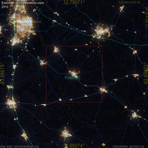
Analysis of Eastman night lights 2016
Square area 10x10 km:
 1.92%
1.92%90-99
2.27%80-89
1.4%70-79
5.42%60-69
8.22%50-59
2.8%40-49
4.9%30-39
4.02%20-29
5.24%10-19
19.41%0-9
44.41%Square area 50x50 km:
0.2%90-99
0.22%80-89
0.22%70-79
0.55%60-69
0.61%50-59
0.32%40-49
0.51%30-39
0.64%20-29
0.62%10-19
1.38%0-9
94.74%Clear (daylight) street map image can be seen on geolist.org.
Map coordinates:
32° 47' 26.6" North, 83° 52' 50.8" West
32° 11' 51.6" North, 83° 10' 39.5" West
31° 36' 2.7" North, 82° 28' 28.3" West
Some cities around Eastman sort by population:
• Warner Robins
62.7 km =39 mi,  317°
317°
• Dublin
46 km =28.6 mi,  34°
34°
• Perry
59.6 km =37 mi,  299°
299°
• Cordele
62.6 km =38.9 mi,  245°
245°
• Fitzgerald
54.1 km =33.6 mi,  187°
187°
• Centerville
68 km =42.3 mi, 315°
• McRae
29.8 km =18.5 mi,  118°
118°
• Hawkinsville
29.3 km =18.2 mi,  289°
289°
4192754 (p: 5,285)
Sources (retrieved 2019-11-25):
» Earth at Night: Flat Maps 2012, 2016