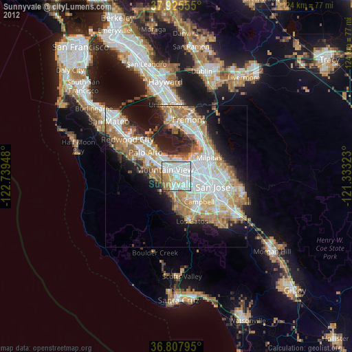
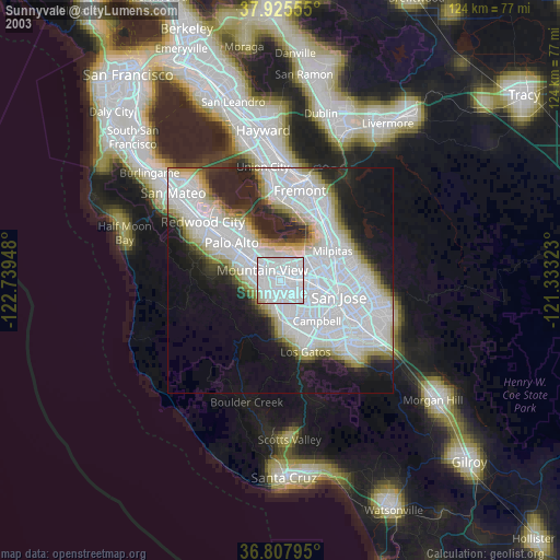
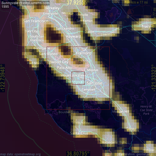
Sunnyvale night lights from space
Night Light of Sunnyvale (California) from space (United States) Src. Average luminocity for 10x10km area is 91.3815% and for 50x50km: 39.2048%.
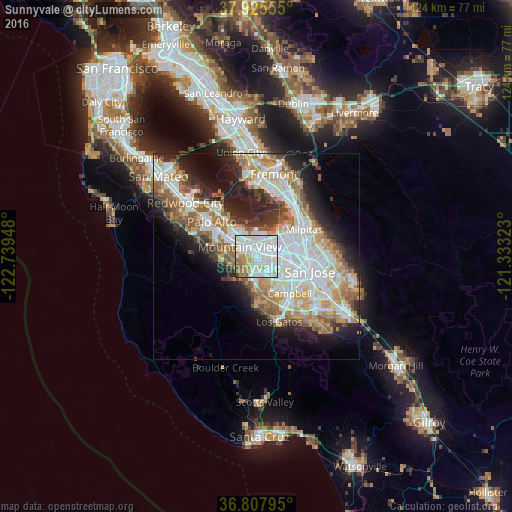
Analysis of Sunnyvale night lights 2016
Square area 10x10 km:
 43.67%
90-99
31.82%80-89
5.19%70-79
5.68%60-69
7.79%50-59
4.22%40-49
0.81%30-39
0.65%20-29
0.16%10-19
0%0-9
0%Square area 50x50 km:
10.46%90-99
9.44%80-89
3.15%70-79
5.53%60-69
5.73%50-59
5.07%40-49
3.38%30-39
3.51%20-29
6.82%10-19
10.03%0-9
36.88%Clear (daylight) street map image can be seen on geolist.org.
Map coordinates:
37° 55' 32" North, 122° 44' 22.1" West
37° 22' 7.8" North, 122° 2' 10.9" West
36° 48' 28.6" North, 121° 19' 59.6" West
Some cities around Sunnyvale sort by population:
• Santa Clara
7.4 km =4.6 mi,  102°
102°
• Mountain View
4.6 km =2.9 mi,  294°
294°
• Palo Alto
12.4 km =7.7 mi,  310°
310°
• Cupertino
5.1 km =3.2 mi,  175°
175°
• Campbell
11.9 km =7.4 mi,  139°
139°
• Saratoga
11.7 km =7.3 mi,  174°
174°
• Los Altos
7.1 km =4.4 mi,  284°
284°
• Los Altos Hills
9 km =5.6 mi, 277°
5400075 (p: 151,754)
Sources (retrieved 2019-11-25):
» NASA, Earths city lights 1995
» NASA city lights 2003
» Earth at Night: Flat Maps 2012, 2016