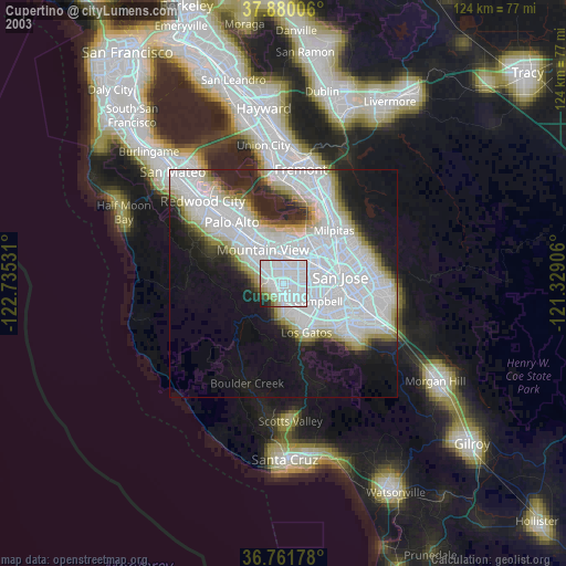
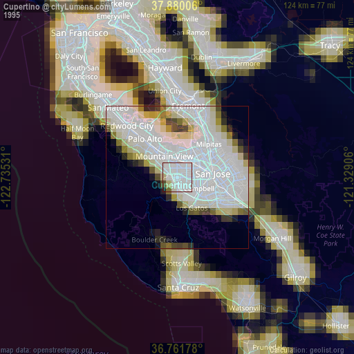
Cupertino night lights from space
Night Light of Cupertino (California) from space (United States) Src. Average luminocity for 10x10km area is 73.1331% and for 50x50km: 35.7932%.

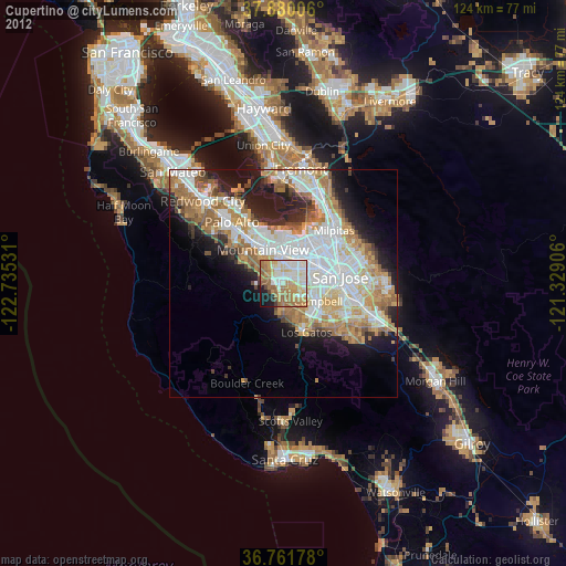
Analysis of Cupertino night lights 2016
Square area 10x10 km:
 16.56%
90-99
21.27%80-89
8.93%70-79
11.04%60-69
15.42%50-59
10.23%40-49
4.22%30-39
2.27%20-29
5.52%10-19
4.38%0-9
0.16%Square area 50x50 km:
9.92%90-99
8.73%80-89
2.75%70-79
4.92%60-69
5.18%50-59
4.7%40-49
3.08%30-39
3.1%20-29
5.74%10-19
8.56%0-9
43.32%Clear (daylight) street map image can be seen on geolist.org.
Map coordinates:
37° 52' 48.2" North, 122° 44' 7.1" West
37° 19' 22.8" North, 122° 1' 55.8" West
36° 45' 42.4" North, 121° 19' 44.6" West
Some cities around Cupertino sort by population:
• Sunnyvale
5.1 km =3.2 mi,  355°
355°
• Santa Clara
7.6 km =4.7 mi,  63°
63°
• Mountain View
8.4 km =5.2 mi,  326°
326°
• Campbell
8.3 km =5.2 mi,  118°
118°
• Saratoga
6.6 km =4.1 mi,  172°
172°
• Los Gatos
11.9 km =7.4 mi,  154°
154°
• Los Altos
10 km =6.2 mi,  313°
313°
• Los Altos Hills
11.2 km =7 mi,  304°
304°
5341145 (p: 60,572)
Sources (retrieved 2019-11-25):
» NASA, Earths city lights 1995
» NASA city lights 2003
» Earth at Night: Flat Maps 2012, 2016