Santa Clara night lights from space
Night Light of Santa Clara (California) from space (United States) Src. Average luminocity for 10x10km area is 98.1948% and for 50x50km: 36.2804%.
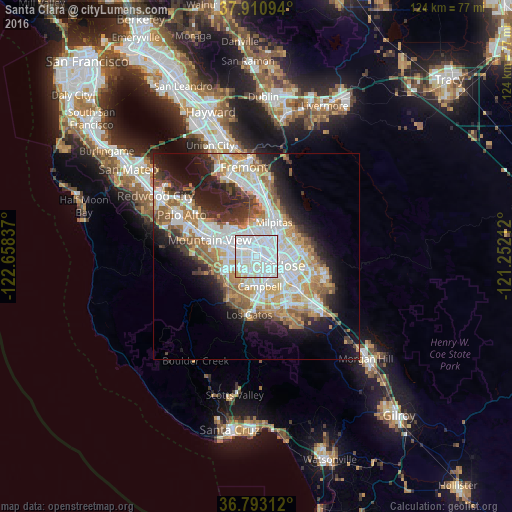
Analysis of Santa Clara night lights 2016
Square area 10x10 km:
 65.58%
90-99
29.06%80-89
3.9%70-79
1.46%60-69
0%50-59
0%40-49
0%30-39
0%20-29
0%10-19
0%0-9
0%Square area 50x50 km:
9.84%90-99
8.6%80-89
2.87%70-79
5.14%60-69
5.32%50-59
4.38%40-49
2.95%30-39
3.23%20-29
6.27%10-19
10.31%0-9
41.09%Clear (daylight) street map image can be seen on geolist.org.
Map coordinates:
37° 54' 39.4" North, 122° 39' 30.1" West
37° 21' 14.8" North, 121° 57' 18.9" West
36° 47' 35.2" North, 121° 15' 7.6" West
Some cities around Santa Clara sort by population:
• San Jose
5.6 km =3.5 mi,  107°
107°
• Sunnyvale
7.4 km =4.6 mi,  282°
282°
• Mountain View
11.9 km =7.4 mi,  287°
287°
• Milpitas
9.3 km =5.8 mi,  27°
27°
• Cupertino
7.6 km =4.7 mi,  243°
243°
• Campbell
7.5 km =4.7 mi,  176°
176°
• Saratoga
11.7 km =7.3 mi,  210°
210°
• Alum Rock
11.4 km =7.1 mi,  83°
83°
5393015 (p: 126,215)
Sources (retrieved 2019-11-25):
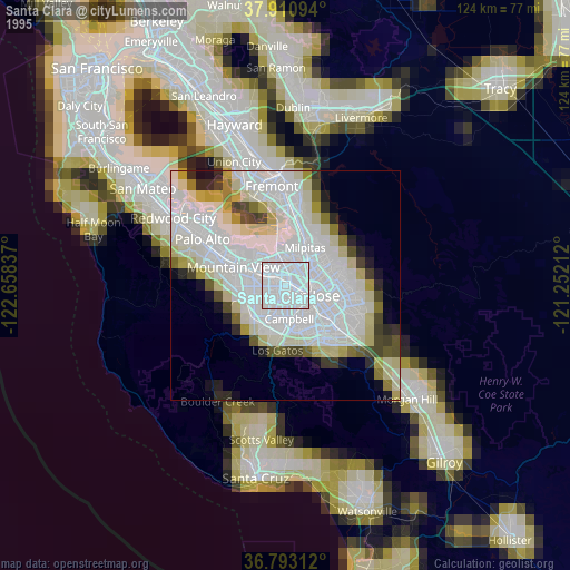
» NASA, Earths city lights 1995
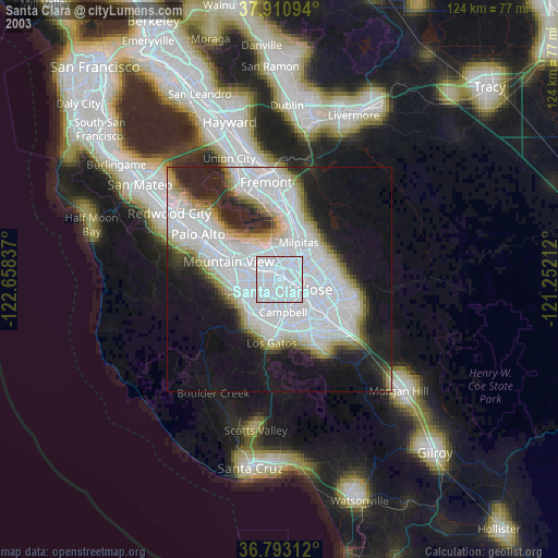
» NASA city lights 2003
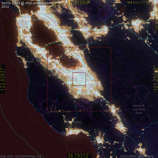
» Earth at Night: Flat Maps 2012, 2016