Campbell night lights from space
Night Light of Campbell (California) from space (United States) Src. Average luminocity for 10x10km area is 85.8639% and for 50x50km: 31.9047%.
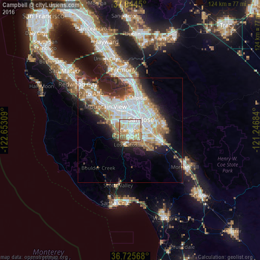
Analysis of Campbell night lights 2016
Square area 10x10 km:
 23.13%
90-99
28.57%80-89
15.99%70-79
14.8%60-69
10.71%50-59
4.93%40-49
1.87%30-39
0%20-29
0%10-19
0%0-9
0%Square area 50x50 km:
9.06%90-99
7.67%80-89
2.26%70-79
4.44%60-69
4.54%50-59
3.88%40-49
2.6%30-39
2.85%20-29
5.13%10-19
8.24%0-9
49.33%Clear (daylight) street map image can be seen on geolist.org.
Map coordinates:
37° 50' 40.2" North, 122° 39' 11.1" West
37° 17' 13.8" North, 121° 56' 59.9" West
36° 43' 32.4" North, 121° 14' 48.6" West
Some cities around Campbell sort by population:
• San Jose
7.6 km =4.7 mi,  39°
39°
• Sunnyvale
11.9 km =7.4 mi,  319°
319°
• Santa Clara
7.5 km =4.7 mi,  356°
356°
• Cupertino
8.3 km =5.2 mi,  298°
298°
• Saratoga
7 km =4.3 mi,  248°
248°
• Los Gatos
7.1 km =4.4 mi,  197°
197°
• Alum Rock
14 km =8.7 mi,  51°
51°
• East Foothills
15.7 km =9.8 mi, 48°
5333689 (p: 41,117)
Sources (retrieved 2019-11-25):
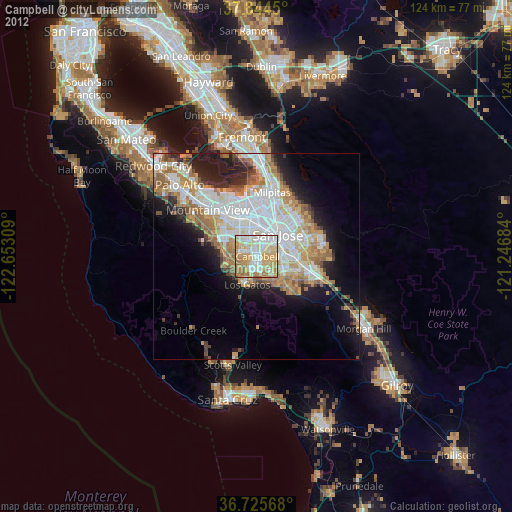
» Earth at Night: Flat Maps 2012, 2016