Mountain View night lights from space
Night Light of Mountain View (California) from space (United States) Src. Average luminocity for 10x10km area is 79.9708% and for 50x50km: 39.4883%.
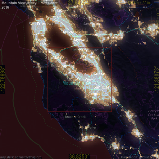
Analysis of Mountain View night lights 2016
Square area 10x10 km:
 26.79%
90-99
25.32%80-89
3.25%70-79
8.77%60-69
15.26%50-59
11.85%40-49
3.41%30-39
2.27%20-29
1.95%10-19
1.14%0-9
0%Square area 50x50 km:
10.62%90-99
9.63%80-89
3.17%70-79
5.41%60-69
5.36%50-59
5.09%40-49
3.6%30-39
3.62%20-29
7.02%10-19
10.27%0-9
36.21%Clear (daylight) street map image can be seen on geolist.org.
Map coordinates:
37° 56' 33.5" North, 122° 47' 13.1" West
37° 23' 9.8" North, 122° 5' 1.9" West
36° 49' 31.1" North, 121° 22' 50.6" West
Some cities around Mountain View sort by population:
• Sunnyvale
4.6 km =2.9 mi,  114°
114°
• Palo Alto
8.1 km =5 mi,  319°
319°
• Cupertino
8.4 km =5.2 mi,  146°
146°
• Menlo Park
11.5 km =7.1 mi,  310°
310°
• Los Altos
2.7 km =1.7 mi,  268°
268°
• East Palo Alto
10.5 km =6.5 mi,  331°
331°
• Stanford
8.4 km =5.2 mi,  300°
300°
• Los Altos Hills
4.8 km =3 mi,  261°
261°
5375480 (p: 80,435)
Sources (retrieved 2019-11-25):
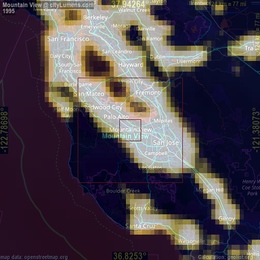
» NASA, Earths city lights 1995
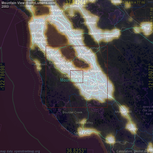
» NASA city lights 2003
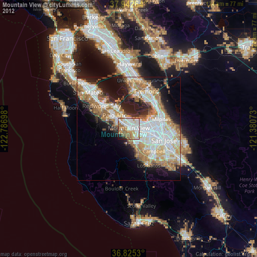
» Earth at Night: Flat Maps 2012, 2016