Palo Alto night lights from space
Night Light of Palo Alto (California) from space (United States) Src. Average luminocity for 10x10km area is 71.7354% and for 50x50km: 40.8076%.
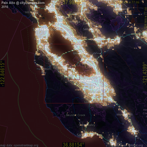
Analysis of Palo Alto night lights 2016
Square area 10x10 km:
 18.99%
90-99
19.97%80-89
3.57%70-79
9.58%60-69
17.53%50-59
10.71%40-49
3.57%30-39
5.03%20-29
9.25%10-19
1.79%0-9
0%Square area 50x50 km:
11.44%90-99
9.91%80-89
2.84%70-79
4.81%60-69
5.35%50-59
5.45%40-49
4.07%30-39
3.89%20-29
7.95%10-19
11.81%0-9
32.48%Clear (daylight) street map image can be seen on geolist.org.
Map coordinates:
37° 59' 53" North, 122° 50' 46.1" West
37° 26' 30.8" North, 122° 8' 34.9" West
36° 52' 53.5" North, 121° 26' 23.6" West
Some cities around Palo Alto sort by population:
• Mountain View
8.1 km =5 mi,  139°
139°
• Menlo Park
3.7 km =2.3 mi,  291°
291°
• Los Altos
6.8 km =4.2 mi,  157°
157°
• East Palo Alto
3 km =1.9 mi,  3°
3°
• North Fair Oaks
6 km =3.7 mi,  307°
307°
• Stanford
2.8 km =1.7 mi,  225°
225°
• Los Altos Hills
6.9 km =4.3 mi,  175°
175°
• Atherton
5.3 km =3.3 mi, 294°
5380748 (p: 66,853)
Sources (retrieved 2019-11-25):
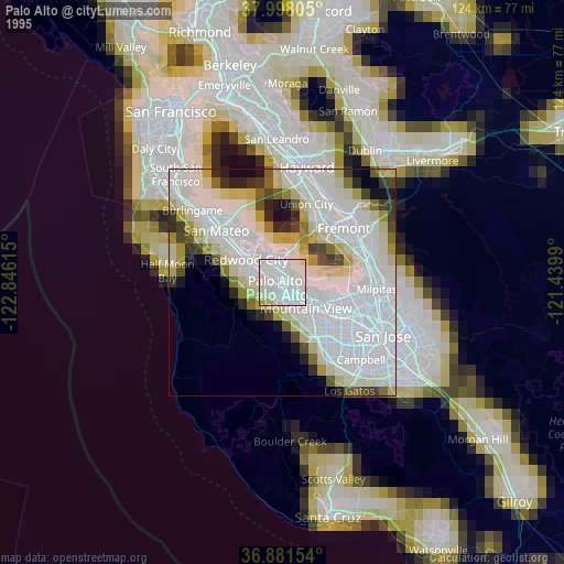
» NASA, Earths city lights 1995
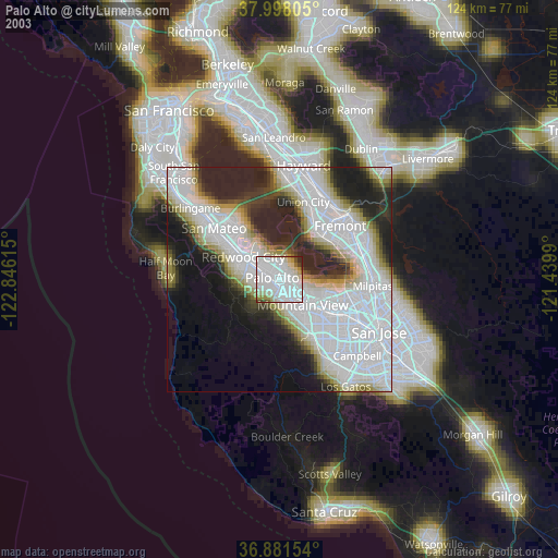
» NASA city lights 2003
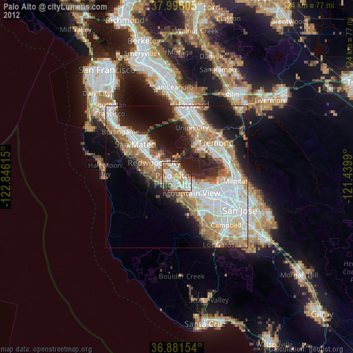
» Earth at Night: Flat Maps 2012, 2016