Sulphur Springs night lights from space
Night Light of Sulphur Springs (Texas) from space (United States) Src. Average luminocity for 10x10km area is 38.8425% and for 50x50km: 2.3398%.
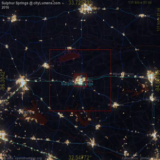
Analysis of Sulphur Springs night lights 2016
Square area 10x10 km:
 2.93%
2.93%90-99
4.4%80-89
8.61%70-79
8.79%60-69
4.95%50-59
7.14%40-49
5.13%30-39
3.48%20-29
5.49%10-19
39.38%0-9
9.71%Square area 50x50 km:
0.11%90-99
0.18%80-89
0.52%70-79
0.37%60-69
0.22%50-59
0.35%40-49
0.27%30-39
0.44%20-29
0.43%10-19
2.09%0-9
95.03%Clear (daylight) street map image can be seen on geolist.org.
Map coordinates:
33° 43' 30.8" North, 96° 18' 15.1" West
33° 8' 18.4" North, 95° 36' 3.9" West
32° 32' 51.8" North, 94° 53' 52.6" West
Some cities around Sulphur Springs sort by population:
• Greenville
47.5 km =29.5 mi,  270°
270°
• Paris
58.2 km =36.2 mi,  4°
4°
• Mount Pleasant
58.9 km =36.6 mi,  88°
88°
• Royse City
70.5 km =43.8 mi,  255°
255°
• Bonham
72.5 km =45 mi,  312°
312°
• Fate
76 km =47.2 mi,  253°
253°
• Commerce
30.3 km =18.8 mi,  293°
293°
• Lindale
71.5 km =44.4 mi,  165°
165°
4734909 (p: 16,098)
Sources (retrieved 2019-11-25):
» Earth at Night: Flat Maps 2012, 2016