Bonham night lights from space
Night Light of Bonham (Texas) from space (United States) Src. Average luminocity for 10x10km area is 20.1575% and for 50x50km: 1.9825%.
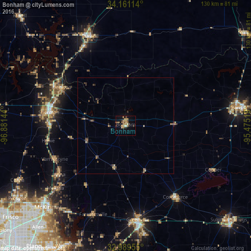
Analysis of Bonham night lights 2016
Square area 10x10 km:
 0%
0%90-99
1.83%80-89
3.48%70-79
6.78%60-69
4.4%50-59
2.93%40-49
1.83%30-39
1.47%20-29
1.47%10-19
8.79%0-9
67.03%Square area 50x50 km:
0%90-99
0.1%80-89
0.35%70-79
0.45%60-69
0.32%50-59
0.34%40-49
0.45%30-39
0.45%20-29
0.37%10-19
0.5%0-9
96.68%Clear (daylight) street map image can be seen on geolist.org.
Map coordinates:
34° 9' 40.1" North, 96° 52' 53.2" West
33° 34' 38.4" North, 96° 10' 41.9" West
32° 59' 22.4" North, 95° 28' 30.7" West
Some cities around Bonham sort by population:
• Sherman
40.4 km =25.1 mi,  279°
279°
• Greenville
49.2 km =30.6 mi,  172°
172°
• Denison
38.6 km =24 mi,  300°
300°
• Durant
49.6 km =30.8 mi,  338°
338°
• Anna
42.7 km =26.5 mi,  233°
233°
• Princeton
53.2 km =33.1 mi,  213°
213°
• Commerce
44.9 km =27.9 mi,  144°
144°
• Melissa
48.9 km =30.4 mi, 228°
4675577 (p: 10,079)
Sources (retrieved 2019-11-25):
» Earth at Night: Flat Maps 2012, 2016