Greenville night lights from space
Night Light of Greenville (Texas) from space (United States) Src. Average luminocity for 10x10km area is 50.1355% and for 50x50km: 8.29%.
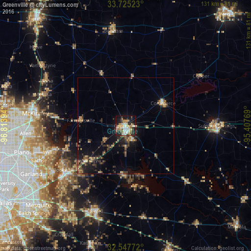
Analysis of Greenville night lights 2016
Square area 10x10 km:
 6.23%
6.23%90-99
11.9%80-89
9.52%70-79
6.41%60-69
7.51%50-59
7.33%40-49
3.11%30-39
6.78%20-29
14.47%10-19
23.08%0-9
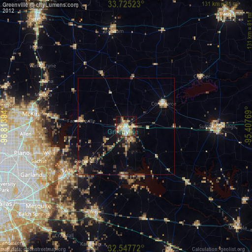
3.66%Square area 50x50 km:
0.4%90-99
0.63%80-89
1.38%70-79
0.95%60-69
1.12%50-59
1.36%40-49
1.28%30-39
2.34%20-29
2.43%10-19
6.09%0-9
82%Clear (daylight) street map image can be seen on geolist.org.
Map coordinates:
33° 43' 30.8" North, 96° 48' 50.2" West
33° 8' 18.4" North, 96° 6' 38.9" West
32° 32' 51.8" North, 95° 24' 27.7" West
Some cities around Greenville sort by population:
• Wylie
42.2 km =26.2 mi,  251°
251°
• Rockwall
39.9 km =24.8 mi,  234°
234°
• Royse City
27.5 km =17.1 mi, 228°
• Fate
33.4 km =20.8 mi, 229°
• Princeton
36.3 km =22.6 mi,  277°
277°
• Commerce
23 km =14.3 mi,  58°
58°
• Melissa
46 km =28.6 mi,  290°
290°
• Lucas
43.8 km =27.2 mi,  262°
262°
4695066 (p: 26,515)
Sources (retrieved 2019-11-25):
» Earth at Night: Flat Maps 2012, 2016