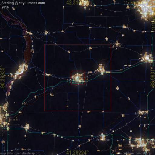
Sterling night lights from space
Night Light of Sterling (Illinois) from space (United States) Src. Average luminocity for 10x10km area is 39.4545% and for 50x50km: 3.8668%.
Analysis of Sterling night lights 2016
Square area 10x10 km:
 2.76%
2.76%90-99
3.57%80-89
8.44%70-79
6.82%60-69
5.19%50-59
7.47%40-49
11.2%30-39
4.06%20-29
6.33%10-19
34.42%0-9
9.74%Square area 50x50 km:
0.24%90-99
0.24%80-89
0.57%70-79
0.6%60-69
0.6%50-59
0.68%40-49
0.88%30-39
0.5%20-29
0.75%10-19
3.25%0-9
91.69%Clear (daylight) street map image can be seen on geolist.org.
Map coordinates:
42° 18' 38.7" North, 90° 23' 57.7" West
41° 47' 19.1" North, 89° 41' 46.4" West
41° 15' 44.1" North, 88° 59' 35.2" West
Some cities around Sterling sort by population:
• Clinton
41.3 km =25.7 mi,  278°
278°
• Freeport
56.8 km =35.3 mi,  6°
6°
• Dixon
18.8 km =11.7 mi,  72°
72°
• Rochelle
54.1 km =33.6 mi, 73°
• Rock Falls
1.2 km =0.7 mi,  148°
148°
• Princeton
50.6 km =31.4 mi,  157°
157°
• Mendota
55 km =34.2 mi,  119°
119°
• Geneseo
53.7 km =33.4 mi,  225°
225°
4912499 (p: 15,057)
Sources (retrieved 2019-11-25):
» Earth at Night: Flat Maps 2012, 2016