Rochelle night lights from space
Night Light of Rochelle (Illinois) from space (United States) Src. Average luminocity for 10x10km area is 39.6794% and for 50x50km: 4.5241%.
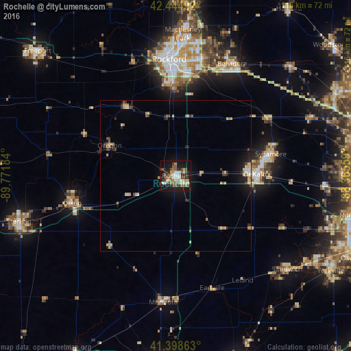
Analysis of Rochelle night lights 2016
Square area 10x10 km:
 6.35%
6.35%90-99
6.03%80-89
4.6%70-79
4.92%60-69
4.29%50-59
8.1%40-49
8.1%30-39
4.92%20-29
8.1%10-19
35.24%0-9
9.37%Square area 50x50 km:
0.39%90-99
0.38%80-89
0.97%70-79
0.52%60-69
0.53%50-59
0.61%40-49
0.69%30-39
0.58%20-29
1.15%10-19
3.34%0-9
90.84%Clear (daylight) street map image can be seen on geolist.org.
Map coordinates:
42° 26' 41.7" North, 89° 46' 18.6" West
41° 55' 26.1" North, 89° 4' 7.4" West
41° 23' 55.1" North, 88° 21' 56.1" West
Some cities around Rochelle sort by population:
• Rockford
38.7 km =24 mi,  356°
356°
• DeKalb
26.3 km =16.3 mi,  88°
88°
• Belvidere
42.1 km =26.2 mi,  26°
26°
• Loves Park
44.1 km =27.4 mi,  1°
1°
• Sycamore
32.4 km =20.1 mi,  77°
77°
• Dixon
35.3 km =21.9 mi,  254°
254°
• Mendota
42.1 km =26.2 mi,  185°
185°
• Genoa
36.5 km =22.7 mi,  58°
58°
4907863 (p: 9,309)
Sources (retrieved 2019-11-25):
» Earth at Night: Flat Maps 2012, 2016