Dixon night lights from space
Night Light of Dixon (Illinois) from space (United States) Src. Average luminocity for 10x10km area is 28.4222% and for 50x50km: 4.292%.
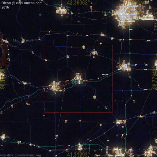
Analysis of Dixon night lights 2016
Square area 10x10 km:
 3.02%
3.02%90-99
1.43%80-89
4.92%70-79
5.08%60-69
5.08%50-59
4.29%40-49
5.56%30-39
4.13%20-29
3.97%10-19
28.1%0-9
34.44%Square area 50x50 km:
0.23%90-99
0.2%80-89
0.75%70-79
0.79%60-69
0.67%50-59
0.74%40-49
0.84%30-39
0.58%20-29
0.77%10-19
3.25%0-9
91.18%Clear (daylight) street map image can be seen on geolist.org.
Map coordinates:
42° 21' 38.2" North, 90° 10' 57.6" West
41° 50' 20.1" North, 89° 28' 46.4" West
41° 18' 46.5" North, 88° 46' 35.1" West
Some cities around Dixon sort by population:
• Rockford
57.6 km =35.8 mi,  33°
33°
• Clinton
58.7 km =36.5 mi,  270°
270°
• Freeport
52.2 km =32.4 mi,  347°
347°
• Sterling
18.8 km =11.7 mi,  252°
252°
• Rochelle
35.3 km =21.9 mi,  74°
74°
• Rock Falls
18.6 km =11.6 mi, 249°
• Princeton
52.4 km =32.6 mi,  178°
178°
• Mendota
44.2 km =27.5 mi,  137°
137°
4889959 (p: 15,319)
Sources (retrieved 2019-11-25):
» Earth at Night: Flat Maps 2012, 2016