Springfield night lights from space
Night Light of Springfield (Illinois) from space (United States) Src. Average luminocity for 10x10km area is 87.4014% and for 50x50km: 12.5483%.
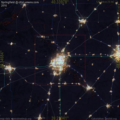
Analysis of Springfield night lights 2016
Square area 10x10 km:
 34.18%
90-99
30.1%80-89
10.2%70-79
6.8%60-69
7.65%50-59
5.95%40-49
3.06%30-39
0.68%20-29
1.36%10-19
0%0-9
0%Square area 50x50 km:
2.12%90-99
2.04%80-89
1.47%70-79
1.57%60-69
1.82%50-59
1.82%40-49
2.2%30-39
1.82%20-29
3.2%10-19
5.41%0-9
76.52%Clear (daylight) street map image can be seen on geolist.org.
Map coordinates:
40° 20' 23.2" North, 90° 20' 48.6" West
39° 48' 6.2" North, 89° 38' 37.4" West
39° 15' 33.9" North, 88° 56' 26.1" West
Some cities around Springfield sort by population:
• Decatur
59 km =36.7 mi,  85°
85°
• Jacksonville
50.6 km =31.4 mi,  261°
261°
• Lincoln
45.3 km =28.1 mi,  31°
31°
• Chatham
14.9 km =9.3 mi,  200°
200°
• Taylorville
41 km =25.5 mi,  133°
133°
• Mount Zion
65.8 km =40.9 mi, 92°
• Carlinville
61.5 km =38.2 mi, 199°
• Pana
66.6 km =41.4 mi, 133°
4250542 (p: 116,565)
Sources (retrieved 2019-11-25):
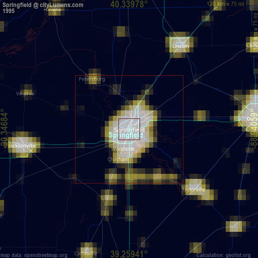
» NASA, Earths city lights 1995
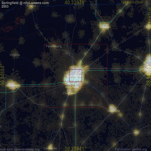
» NASA city lights 2003
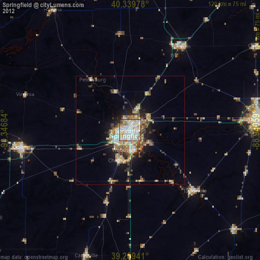
» Earth at Night: Flat Maps 2012, 2016